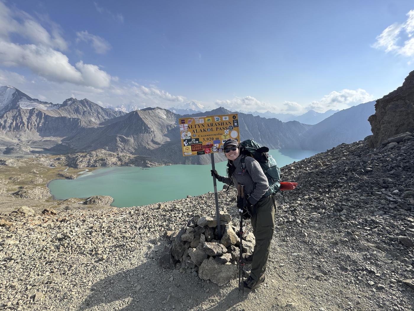
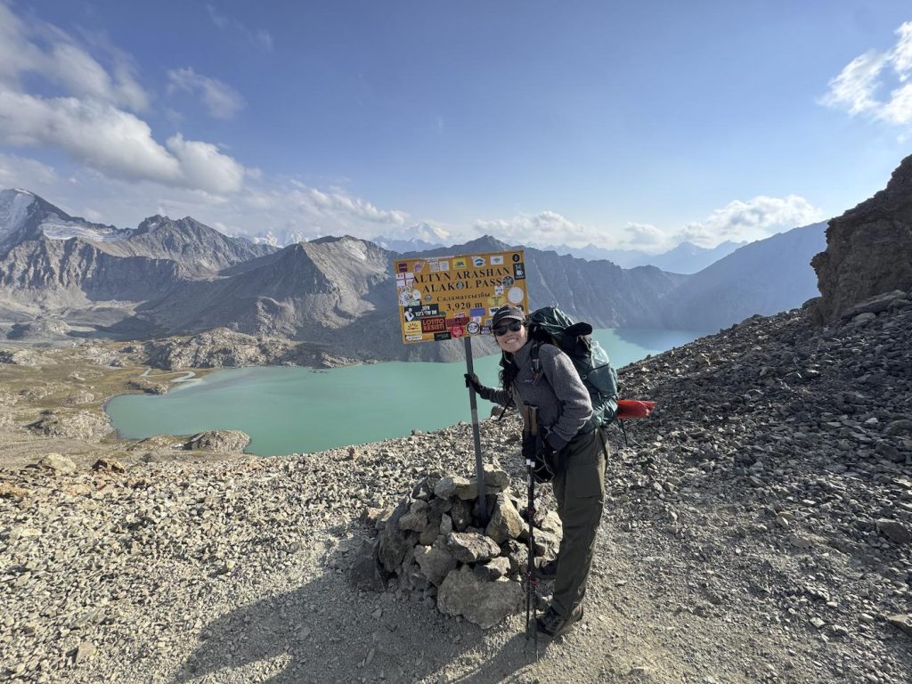
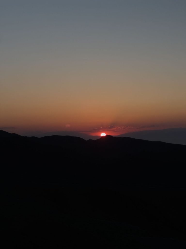
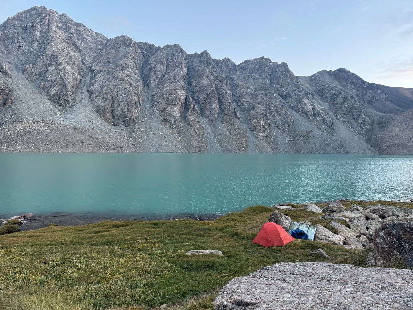
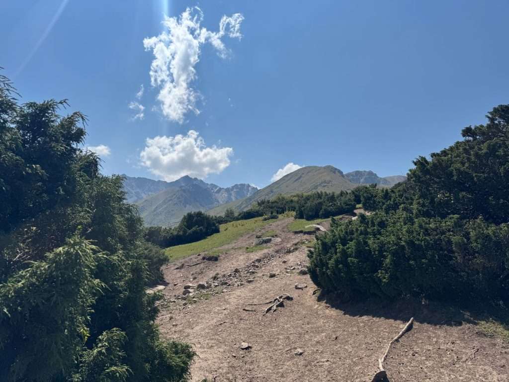
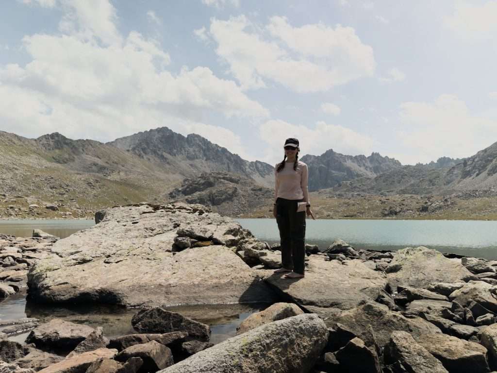
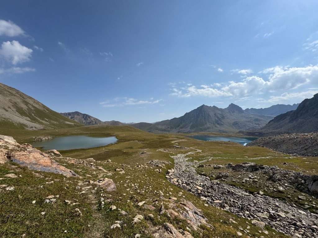
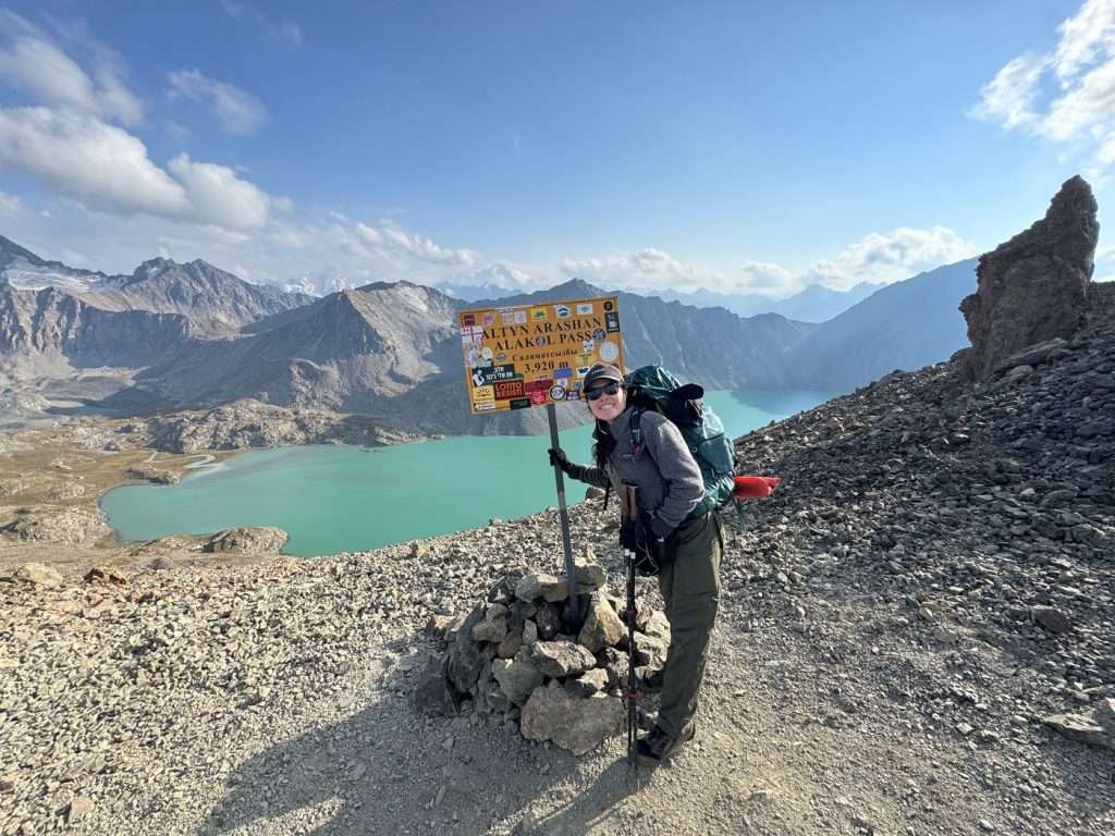
When I reached the highest pass of the Ak Suu traverse and marveled at the aqua blue lake, I had to take a photo for the memories!
I spent $547 USD hiking the Ak Suu traverse (135 km / 84 mi) in 9 days 2025. This includes lodging, transport, trail expenses and food.
There are multiple strategies you can choose from with lodging with food, allowing you to camp the entire way for as little as $150 or go yurt-to-yurt for $485. Alternatively, you can opt for an all-inclusive guided tour for $1225 – $2615.
This guide breaks down every cost so you can spend on what matters to you. Factors like gear rental, transportation, food and lodging are all considered. For complete route details and day-by-day itinerary (7 – 9 day variations), see my Ak Suu Traverse Guide.
Complete cost breakdown: 9-day Ak Suu traverse (USD) by lodging and food strategy
Lodging/Food
Cooking
Warm meals (yurt)
Purchase dehydrated
Tent
$147
$309
$417
Yurt-to-yurt
$462
$624
$732
Guided all-inclusive
$1250 – 2815
E.g. if you camp in a tent on all nights and eat dehydrated meal packs, you will spend a total of $417.
The above includes one-time costs:
SIM card with unlimited WiFi ($5),
inter-city public transport ($20.5),
220g butane canister ($10),
night-before lodge ($30)
and excludes optional hidden costs (~$20). Your costs may differ based on the number of days on trail and other factors.
Daily costs
Lodging Strategies and Costs: Tent Camping vs Yurt-to-Yurt
I personally love my daily ritual of setting up and taking my tent down. It gives me the solitude and freedom that I seek while I immerse in nature.
I love the flexibility and independence that comes with being able to set up camp wherever and whenever I want!
However, flexibility and optionality of lodging in case of inclement weather was helpful. I stayed in a hostel room in Altyn Arashan to recharge my devices in the middle of my trip, and in a yurt at the end to escape a forecasted thunderstorm.
0 KGS or $0/night with a tent: Kyrgyzstan is the land of the nomads – with a tent on your back, you have the freedom to pitch overnight anywhere in the backcountry with minimal costs. Just be considerate not to pitch on paid campsites or on someone else’s property.
~1750 KGS or $20/night with rented tent and gear: This cost is only an estimate based on tent, sleeping bag and sleeping pad. I brought my own camping gear and this saved me money and trouble with renting gear. However, in case you are considering renting gear, you can rent from from Karakol Visitor Center. You can also rent gear in Bishkek from: Ecotrek, Kyrgyz Life.
3000 KGS or $35/night at a yurt: A bed in a shared yurt ranges between 2500 – 3500 KGS ($29 – $40 USD) and usually includes free flow hot tea, breakfast and a shared bathroom. For solo travelers, yurts are only assigned to same genders unless you are traveling together.
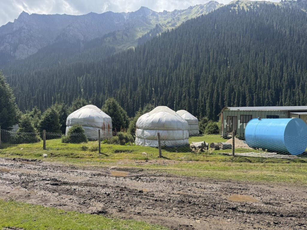
Just some of the yurt options by the road in Altyn Arashan
At Altyn Arashan, a hot springs town (around day 5) where lodging is priced at a premium, there are lodge options aside from yurts. Yurts are also pricier due to the increased traffic from the overlap with the shorter Ala-Kol trek:
0 KGS ($0 USD) with a tent: you simply have to find a clear spot by Arashan river
1500 KGS ($17 USD) for a bed in a hostel (I stayed at Arashan Hotel) or
Higher prices of 3500 – 4500 KGS ($40 – $50 USD) for a yurt
Budget breakdown in KGS
Daily cost
Except: in Altyn Arashan
Budget (tent)
0 (tent)
0 (tent)
Budget (rented tent & gear)
1750
1750
Middle
3000 (shared yurt)
1500 (dorm room)
Comfort
3750 (private yurt)
4500 (private yurt)
Food Strategies and Costs
It is important to consume nutritious and calorie-dense food to succeed at trekking this intense trail. I personally burned close to 3000 kcal each day. To fuel my adventure, I brought dehydrated food from my previous destination (Europe), pre-packed a custom trail mix (roughly half kilo of nuts for lunch every day), and had a handful of warm meals on the trail.
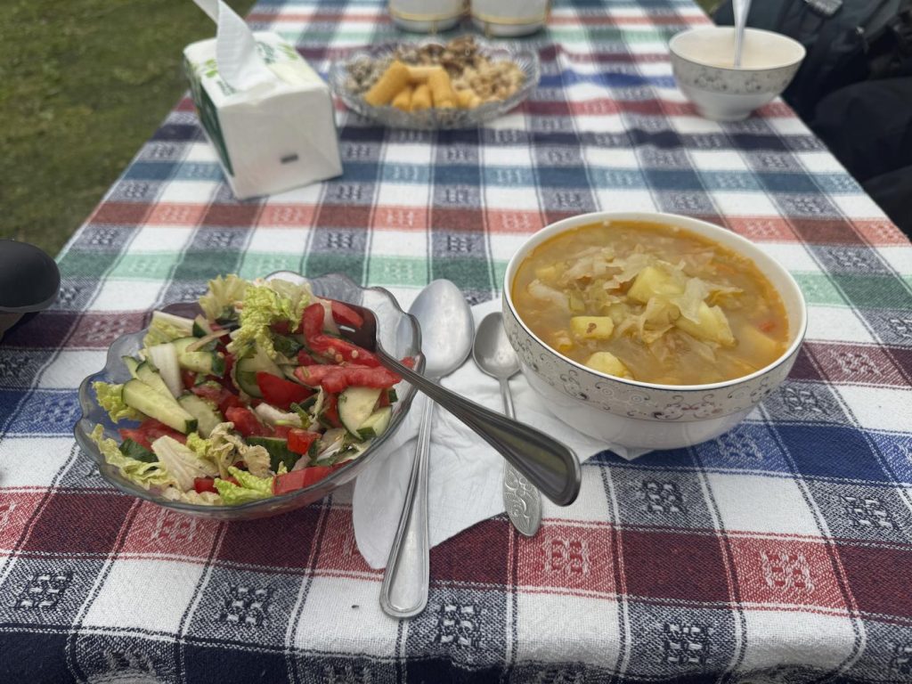
I really welcomed fresh vegetables and warm soup for lunch on my fifth day – when I reached Altyn Arashan in the middle of my trek.
Here are the per-meal costs depending on your strategy:
Cooking on the trail for ~$3 USD/meal: You can purchase canned or dried food from grocery stores in Karakol or Jyrgalan before setting off on your trek. However, you would face a weight trade-off – as the trek is 9 days long, I would not recommend carrying your own food.
Pros:
Cheapest option
Some control over nutrition (protein, carbs, calories)
Cons:
Heaviest option (rice, canned fish, etc.)
It takes time and fuel to cook on the trail
Limited canned or dry options in Kyrgyzstan
Warm meals at 650 KGS ($7.40) for breakfast/lunch & 850 KGS ($9.70) for dinner: yurt and lodging options on the trail will offer breakfast, lunch and dinner at fixed timings for all guests. Lunch options are usually available for take-away. However, given the remote nature of these lodges, I have found the food value and quality to be questionable at times. You may also arrive too late for the camp hosts to account for your meal – so be prepared to have back up.
Pros:
Warm meals at yurts include fresh fruits and vegetables that you would usually not pack due to water weight
Cons:
Inflexible start/end timing and location
Least control over nutrition
Uncertain availability of meals
Pre-purchase dehydrated food for $13 USD/meal: Kyrgyzstan does not have restrictions on food brought in for personal use, so I brought in my own dehydrated food as these cannot be purchased in Kyrgyzstan. If I had more time I would dehydrate my own recipes (I love to dehydrate kimchi soup!), but otherwise I’ll purchase dehydrated or freeze dried meals based on their nutrition-price-taste trade off:
USA options / $13 USD, my favorites are Peak Refuel’s Beef Pasta Marina and Backpacker’s Pantry Pad Thai with Chicken.
European options / 12 EUR: I recommend Real Turmat’s Beef Stew and Fish Curry (these were the most protein and calorie-dense options).
Homemade options / $6 USD: there are a variety of homemade dehydrated food recipes that are cost effective but time expensive. I’ve averaged $6/meal for a ground beef pasta with tomato base, and $6 meal for kimchi soup, ground beef a lentil/rice mix.
Pros:
Best control over nutrition and predictability over taste
Maximum flexibility on meal times and cooking
Cons:
You will have to pack your food into Kyrgyzstan
Estimated Budget Breakdown
Per-meal cost
Cooking on trail
$3
Warm meals
$9
Pre-bought Dehydrated meals
$13
One-time costs
Travel logistics: SIM card and mobile data
Getting an eSIM with data for Kyrgyzstan was a breeze with O!, which is a local mobile data network. I downloaded the O! app prior to my arrival and signed up for a 4-week 540 KGS ($6.20 USD) unlimited data plan. The app requires you to input your passport details and verify your identity with a selfie- after that an eSIM will be issued.
There is also a SIM store at the airport itself (note: physical SIM only), but I appreciated the ease of sorting out my data before arriving.
Tickets and national park passes
The Ak Suu traverse does not require any tickets or national park passes unless you cross into Karakol National Park like I did (due to weather conditions, I rerouted from Telety Valley to Karakol Valley the day before my last day). You will pass a ranger’s booth, and he will issue you a receipt for a 300 KGS ($3.43) entry fee.
Inter-city Transport Options and Costs
If you are landing and departing from Bishkek, you will have to arrange for transport from Bishkek to the starting point of the Ak Suu traverse by Jyrgalan village. The Ak Suu traverse ends in Jeti-Oguz resort, where you can leave for Bishkek. Variations of the itinerary (e.g. starting or ending at a different point in the trail) may affect your costs.
Public inter-city vans, marshrutkas – $20 the whole way: marshrutkas are the minivans that provide intercity transport. They leave from specific bus terminals and usually accommodate any stop along the route that you verbally indicate to the driver.
They travel at similar speeds to private transport, but may require you to wait till the time for departure or even to stand. When I was leaving from Karakol to Jyrgalan, the marshrutka scheduled for 1.30pm ended up leaving a little after 2PM. As I got there early at 1PM to get a seat, I ended up sitting idle for over an hour. On the road, some elderly folks boarded the marshrutka, so I gave up my seat and had to stand while the van sped down the highway for another hour.
Here are the cash ticket fares for each route:
Marshrutka Route
Ticket price
Luggage fee
Total
Bishkek to Karakol
550 KGS
200 KGS
750 KGS
Karakol to Jyrgalan
150 KGS
50 KGS
200 KGS
Jeti-Oguz to Karakol*
40 KGS
50 KGS
90 KGS
Karakol to Bishkek
550 KGS
200 KGS
750 KGS
Total costs
1790 KGS
*Due to a detour from Telety Valley to Karakol Valley due to rainy weather, I returned to Karakol via Karakol Valley and did not get to Jeti-Oguz. These prices are from research on the internet.
Shared taxis (carpooling) – dependent: shared taxis are a mid-point option between marshrutkas and private transport. These depart and arrive at bus terminals, similar to marshrutkas. The driver will stand by their taxis and wait for a sufficient number of passengers to split the total fare in a specific direction. By choosing this option, you can save waiting time and perhaps travel in relative comfort if the taxi is not packed full.
Private transfers – dependent but exorbitant: private transfers will be your most convenient but most expensive option. Outside of Bishkek and Karakol, ridesharing apps like YandexGo! do not work. Private transfers need to be arranged at least a few hours in advance with via WhatsApp with Destination Jyrgalan or Destination Karakol’s transfer partners. I did not take any private transfers, but I was quoted $75 – $100 USD for a 1 hour drive from Kok Jaiyk (slightly before Jeti-Oguz) to Karakol.
Alternatives to self-guided trekking: Porter and Tour costs
If you are looking for company to trek the Ak Suu traverse or help with a heavy load during this long hike, you can opt to hire a guide, a porter or to join a tour group.
It is advisable to hike with company if you are inexperienced, as the trail on the Ak Suu traverse may not always be clear or obvious. I had to do quite a bit of wayfinding and sometimes confused animal trails for human ones. If you would like my GPX route and day-by-day recount of my trek, see my Ak Suu Traverse guide.
Destination Karakol’s 7-day itinerary includes tents (except for a night in Altyn Arashan with yurt/lodge), food, and porters for $2815 USD per person. It goes down to $1226/person if the you get a group of six people. Sleeping bags are separately rented for $3/night ($21 for the 7-day trip).
$450 ($50/day) for a 15-kg limit porter service can be arranged through Destination Karakol. I saw these porters on the trail – these are local boys that look anywhere between 7 and 14 years old running up and down the mountains with ill-fitting and oversized backpacks on their back, working during the summer peak season (which also coincides with their school holidays). If you decide to hire a porter, I would ask that you pack considerately!
Trekking type
Costs in USD
Self-guided
$0 additional cost
Self-guided with porter
Self-guided + $450
Guided 7-day Ak Suu traverse
$1225 – $2815
Guided 9-day Kyrgyzstan including Ak Suu traverse
$1858 – $2615
Where you can save money
Bring your own camping gear rather than rent
With the exception of trekking sticks, a prudently packed camping backpack should fit onto a plane without the need to purchase checked baggage.
However, if you need to buy new gear, it’s probably worth considering renting gear to keep costs low unless you are confident you’ll camp or hike often. As they say – cry once and buy once.
Sleep in your tent whenever you can
By setting up your tent, you’ll spend $0 incremental dollars on lodging for the night! I chose to stay in lodging in the middle of my trip to reset and charge my camera gear, as well as at the end only due to inclement weather.
Opt to cook or prepare your own dehydrated food
It is important to nourish your body with food that supplies enough for recovery and fuel. I do not recommend eating light or junk food for all 9 days on the trail. Instead, I recommend cooking on the trail (at the trade off of heavier weight) or preparing your own dehydrated food at home to bring onto the trail.
I also brought a half liter plastic bottle worth of olive oil – 2 tablespoons provides ~250 kcal for each meal. This is my cost efficient and tasty hack for powering through 3000 kcal days!
Cross the Day 2 river on foot
I paid 1000 KGS ($11) to the little entrepreneur who helped me cross the river. However, if you’re comfortable with waist-high water and have waterproofed your valuables, you can save this money by crossing yourself.
Hidden Costs: river crossing, WiFi access, Altyn Arashan Hot Springs
Aside from the aforementioned costs, I did not anticipate these while on the trail:
A fellow hiker wades knee deep in the shallower part of the river as a mid-day treat.
River crossing fee for 350 – 1000 KGS / person where a bridge had been washed away. This river is waist high and is crossed on day 2, between Terim Tor Buluak and Boz-Uchuk lakes. Depending on your group size or negotiating chops, you may be able to pay the lower end of this range. You can avoid this cost by taking a ~2KM detour.
100 – 200 KGS / person WiFi access at Altyn Arashan. The Kyrgyz Life / partner Ernis Yurt Camps charge 200 KGS for WiFi access, but it was choppy and slow. Arashan hotel charges 100 KGS for WiFi powered by Starlink. You can use the WiFi at either of these lodge’s common areas.
250 KGS / person to access hot springs at Altyn Arashan. The natural hot springs near this village are few and rather disappointing, although they make for fun memories and good adventure. If you’re serious about soaking in clean and hot water, you’ll have to pay to access private hot springs around the village. This is the admission cost at Arashan Hotel – you would likely be grouped with people of the same gender or your travel companions (if appropriate).
Emergency cash
You will not be able to transact with locals without cash – so be sure to pack some emergency cash on you. I had an extra 10,000 KGS ($115 USD), which came in helpful when I needed to seek shelter from a rough thunderstorm in a yurt.
Can I pay with credit card on the Ak Suu traverse?
No! Aside from bigger establishments in Bishkek and Karakol, please have cash on you for lodging, emergencies and transport fees. ATMs can be found in Bishkek and Karakol, but not in Jyrgalan and no where on the trail.
Want a Budget Calculator?
If you’d like a spreadsheet to help calculate your budget or estimated costs, please drop me an email at weiting[at]weitingwanders.com. I have a template for you!
Is the Ak Suu Traverse Worth the Cost?
To me, this was a beautiful and value-added adventure on a trail that offered solitude and breathtaking sights for only a fraction of the costs to hike other trails in Europe (where you would have to pay for campsites or huts). It would probably have come out to similar costs on a US backcountry trail considering that I mostly ate dehydrated meals.
Despite the money you would save compared to joining a tour ($700 – $1300 saved per person), you should only attempt the Ak Suu trail with the intention to camp every night only if you enjoy the process. Given the length and difficulty of this trek, no amount of money saved can help you enjoy your trip.
However, if you are looking for a guided adventure for a shorter length, consider joining an Ala-Kol guide group. The Ala-Kol trek is usually 3-days and 2-nights, spanning the most popular parts of the Ak Suu traverse: Ala-Kol lake and Altyn Arasha.
Compared to guided tours ($1225 – $2815), hiking independently saves you $700 – $1300 while giving you flexibility over your pace and adventure. For more detailed information, check out my complete Ak Suu Traverse guide.
Addendum: my line-by-line spending
In case you’re curious about my actual expenditure breakdown – see below.
Day
Item
Mixed tent/lodge camping
Pre-arrival
14x dehydrated meals
$182 USD
Arrival day
eSIM
500
Marshrutka from Bishkek to Karakol
750
Map of Karakol & Jyrgalan trekking
500
Gas cannister ~220g
700
Groceries for trek (nuts, raisins, milk, chocolate, olive oil)
1700
Karakol lodging (incl. breakfast)
4785
Dinner in town
315
Day 0
Marshrutka from Karakol to Jyrgalan
200
Lunch in town
145
Jyrgalan lodging (incl. breakfast)
3900
Dinner at lodge
800
Day 1
Packed lunch for day 1 of trek
400
Day 2
River crossing tip for boy on horseback
1000
Day 3
Yurt camp + breakfast + dinner
0
Day 4
Yurt camp + breakfast + dinner
Day 5
Lunch at lodge
800
Altyn Arashan lodging (incl. breakfast, hot springs)
1500
Arashan Hotel / Kyrgyz Life WiFi
100
Dinner at lodge
950
Day 6 (rest day)
Altyn Arashan lodging (incl. breakfast, hot springs)
1500
Dinner at lodge
900
Day 8
Karakol Valley yurt bed
1750
Karakol national park fee
300
Dinner at lodge
750
Treats at shop by Karakol river (beer and a banana)
500
Day 9
Private driver from Karakol bridge to Karakol (2000 for one taxi)
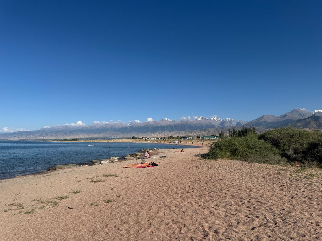
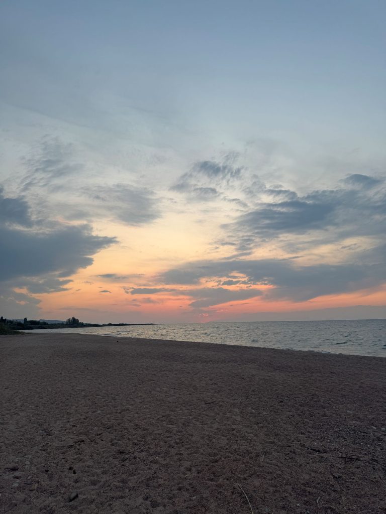
Tosor is a small village sitting on the south shore of Issyk-Kul Lake, the second biggest alpine lake in the world. It offers serene and undeveloped beach access to the lake, where one can enjoy quiet beach time after adventurous hikes and treks and admire the sunset. One can even view glaciers and far-reaching mountains from the lake, a sight that will take your breath away.
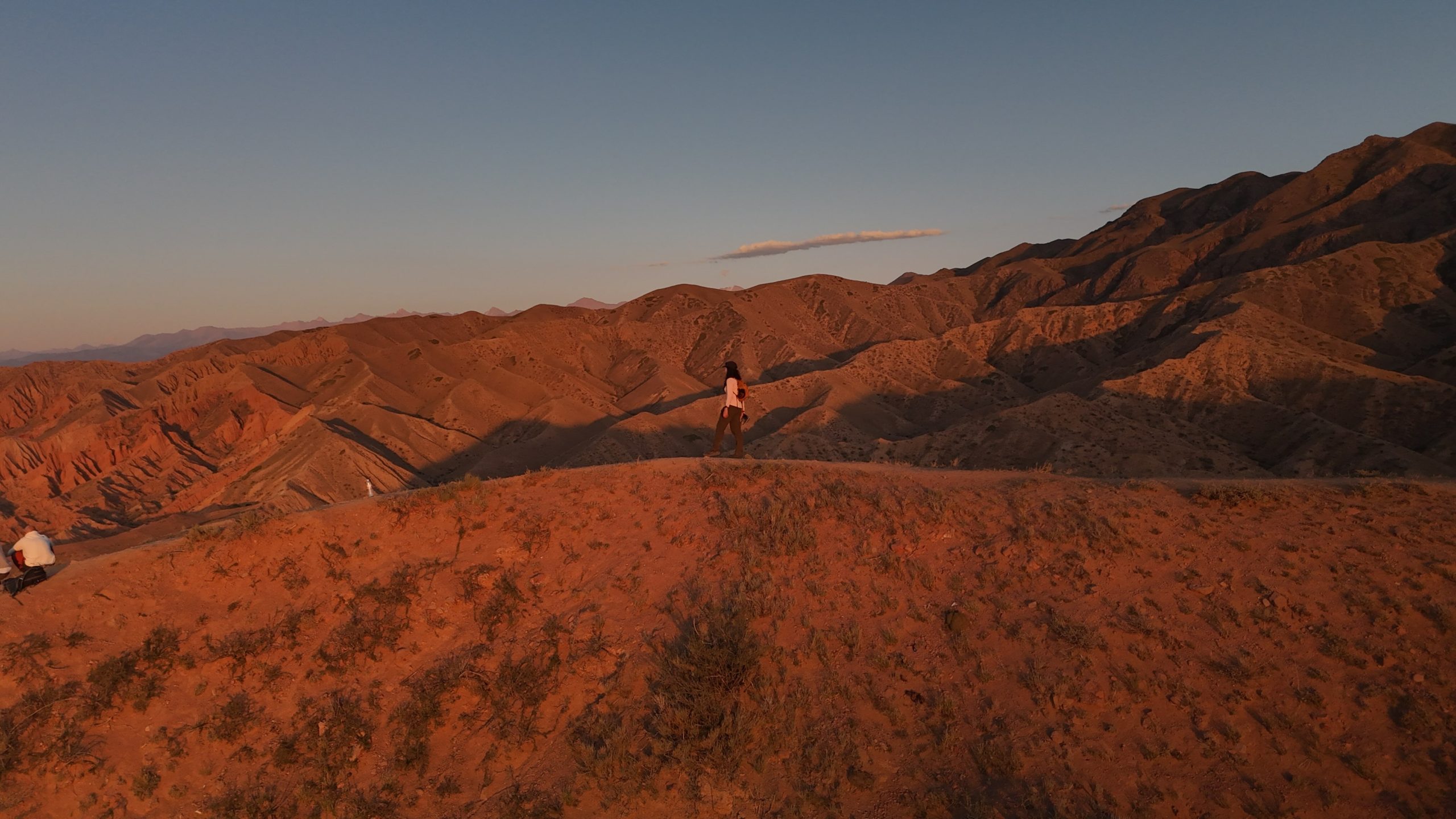
Tosor is also the closest village (5 minutes drive) to Skazka Canyon, or Fairytale Canyon, known for its dramatic sandstone cliffs and walls featuring tones of reds, yellow, orange and even tinges of green and purple. ‘Skazka’ in Russian means ‘fairytale’, alluding to how the canyons fuel imaginations.
The small size of the village allows you to enjoy both the beach and the nearby Skazka Canyon in a mere day.
1-Day Itinerary in Tosor: Skazka Canyon and Beach Bliss
With a marshrutka
Time
Activity
1100
Arrive in Tosor, check-in with host and leave luggage
1130
Have brunch/lunch
1215
Wait for a marshrutka at the Tosor village bus stop (Google Maps pin, Mapy) heading in the direction of Skazka Canyon (hourly)
1330
Arrive at Skazka Canyon – take a hike up the entrance to the main viewpoint
1430
Enjoy the view from the main viewpoint
1445
Free and easy time
1500
Hike back to the main road, wait for a marshrutka or hitchhike back to Tosor
1700
Rest and enjoy the sunset from Issyk-Kul Lake
1930
Have dinner at accomodation or at a restaurant
2030
Shower and stargaze from your lodge
With a car
Time
Activity
1100
Arrive in Tosor, check-in with host and leave luggage
1200
Have lunch in Tosor village
1300
Enjoy the beach by Issyk-Kul Lake
1800
Drive to Skazka Canyon
1815
Arrive at Skazka Canyon – take a hike up the entrance to the main viewpoint
1830
Enjoy the view from the main viewpoint
1845
Free and easy time, enjoy the sunset (around ~7.45pm in mid-August)
2000
Drive back to Tosor
2030
Late dinner at a restaurant in Tosor
2130
Shower and stargaze from your lodge
Tosor’s serene beach on the Southern shore of Issyk-Kul Lake
Issyk-Kul Lake is the second largest alpine lake in the world, and is surrounded by the beautiful Tian Shan mountains and glaciers that you can admire from the beach shores.
Tosor sits on the southern shore, offering at-your-door access to a beautiful pebble beach with clear waters. The Southern shore (as of time of this writing) is serene, calm and clean, in contrast to the Northern shore, where it is more developed, with beach clubs, umbrellas and resorts.
While Issyk-Kul Lake translates to ‘warm lake’, the lake is not warm but slightly below body temperature. The waves are strong, but not dangerous. One can still take a refreshing dive in, or sunbath on warm pebbles during summer months.
The beach was never too crowded while I was there, and you can rent stand up paddles and kayaks from local vendors directly on the beach. There are also umbrellas and a stretch of beach cordoned off by some trees for privacy towards the west side of the shore.
Lastly, the undeveloped nature of the shore means you can get unfettered access to sunsets. These are absolutely gorgeous, especially when the golden rays hit the mountain ranges in the backdrop.
A 2025 review: is Tosor worth visiting?
How to get to Tosor, Kyrgyzstan by public transport
Getting to Tosor from Karakol
Go to the Karakol south side bus station and ask for a marshrutka minivan heading towards Bokonbaevo. Let the bus driver know that you wish to get off at Tosor. Closer to Tosor village (keep a lookout on your phone), let the bus driver know exactly which street intersection you want to alight. The trip should take you XYZ hours long and cost you.
Getting to Tosor from Bishkek
Go to the Bishkek west bus station and look for marshrutka minivans headed to Karakol. Speak with the driver and ask whether the route passes through Tosor – on the southern shore of Issyk-Kul Lake. The more common route passes through the northern shore, and you don’t want to be on the wrong marshrutka!
From the street intersection where you are let off, you will have to walk on a loose gravel road (try to avoid rolling luggage if possible) to your accomodation. There is no intracity ridesharing like Yandex Go in the smaller village of Tosor.
Where should you stay in Tosor?
You can camp in your tent or choose to stay at a guesthouse or in a yurt on the beach shore.
As it goes in nomadic Kyrgyzstan, open camping is allowed as long as it is done in a considerate manner. I, however, do not recommend leaving your tent out throughout the day, as UV rays will degrade tent fabric over time. Camping spots are marked out on Mapy.com here:
Alternatively, you could stay at a guesthouse. I wanted some privacy after my 9-day Ak Suu traverse trek, so I booked a room at Tunuk Guesthouse. Their one-bedroom house offered me the privacy I needed to rest and recoup. They even have laundry and a gorgeous apple orchard. While their listing indicates a kitchen and a sauna – I do not recommend booking their place for these. The kitchen was shared and barely equipped, and the dimly lit sauna did not look inviting.
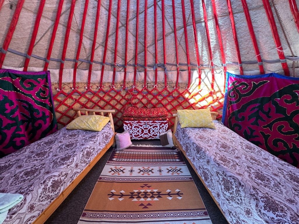
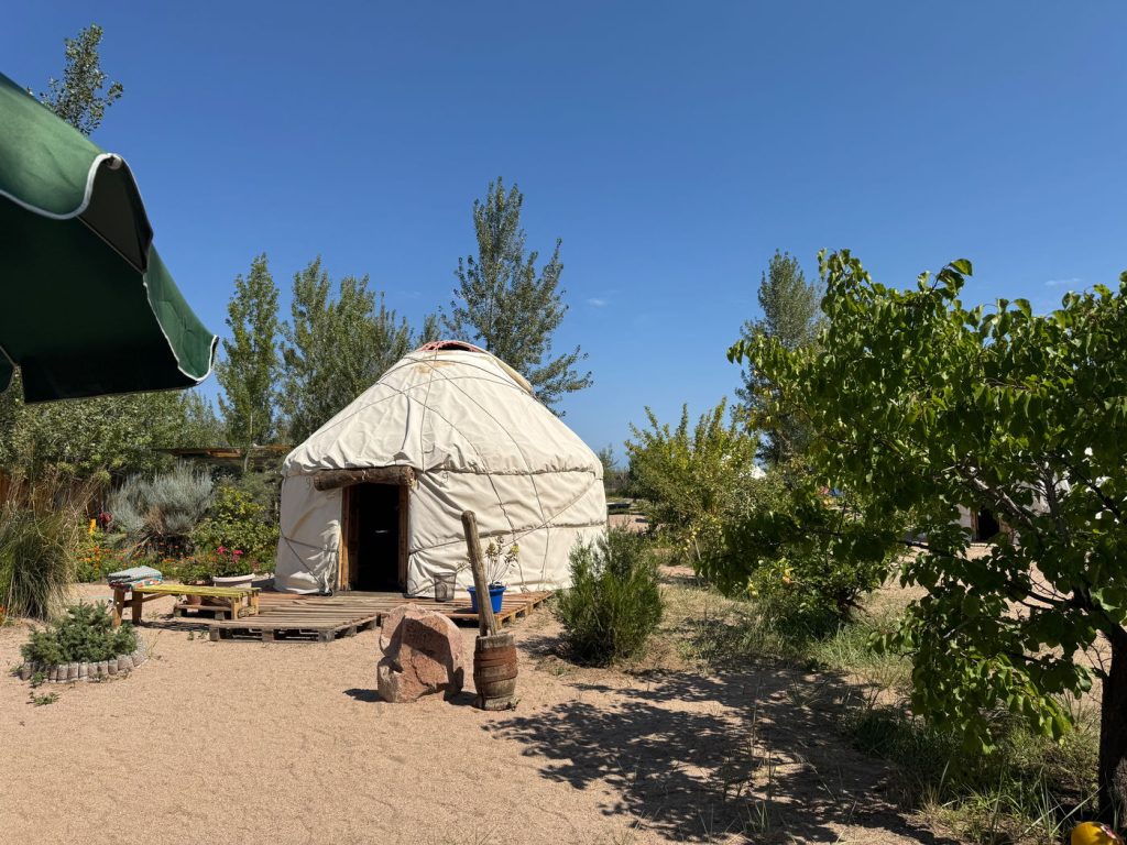
I also spent a night at Tonja’s Tosor Yurt Stay. The yurts were gorgeous, spacious, and right on the shore of the beach. If you are looking to meet others and experience Kyrgyzstan’s yurts, I can recommend Tonja’s yurt camp. A bed includes a breakfast in the morning comprising porridge, bread with spreads and cheese, and fresh fruit.
What should I eat in Tosor?
Chances are, your guesthouse or yurt stay will offer breakfast in your nightly rate. Lunch and dinner can be added on for roughly 800 KGS, and enjoyed communally with other guests.
However, you can also dine out. I can recommend these restaurants:
Cafe Bayastan Review
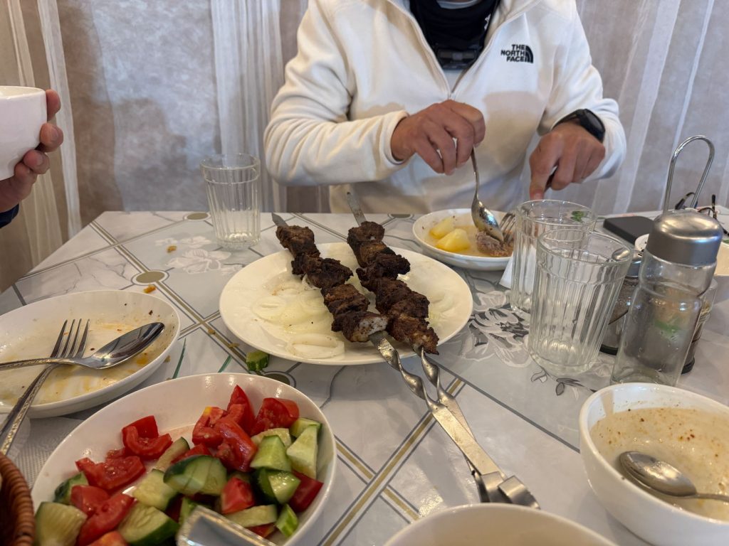
I had a hearty meal at Cafe Bayastan (Kafe Баястан) with two companion travelers I met at my yurt stay. We enjoyed shashlik, cucumber and tomato salad, plov, lagman and a bowl of Shorpo:
Shashlik is grilled chunks of meat with spices (usually cumin-heavy) – we ordered beef Shashlik off the menu for a fair price
Plov – rice soaked in the oil and juices of fried shredded meat and vegetables; very delicious!
Lagman – noodles stir fried with vegetables and small amounts of meat; this is not to my taste, I felt like it was merely a combination of ingredients, but to each their own
Shorpo – a hearty clear soup of potatos, chunks of beef, and carrots. Just what I needed after my day hike at Skazka Canyon!
KAFE CHATYR review
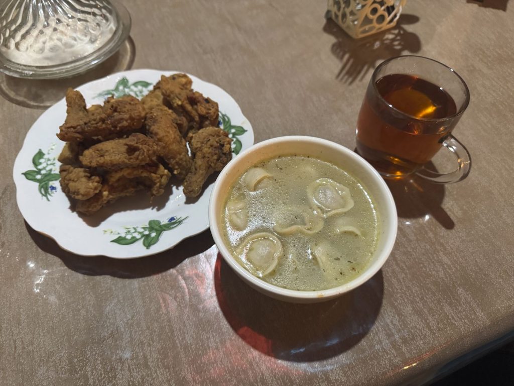
On another evening, I had dinner at KAFE CHATYR. It was a humble place run by a mother and her daughter, but the food was delicious. I ordered a plate of fried chicken (10 pieces), manti, and a cup of chai. The fried chicken was crispy, and the manti was comforting – especially because we had a blackout due to a thunderstorm during my meal.
Where can I buy groceries or draw cash in Tosor?
You can buy groceries and find an ATM at Tosor Market by the main street. This is the biggest supermarket in Tosor. The ATM is located by the entrance on the outside of the store, so you can draw cash even if the supermarket is closed. This market is a maximum of 15 minutes walk from anywhere in Tosor village.
Alternatively, you can buy groceries at the smaller Tosor Market in the middle of the village.
What is the weather like at Tosor?
Weather in Tosor is seasonal, with the summer months of May to August being the hottest before the area cools down from September. August, when I went, is the warmest month with average temperatures of 24 degrees Celsius. The months before and after – July and September – average 20 – 22 degrees Celsius.
However, while temperatures can be warm in the day, it can drop rapidly in the evening. August brings about average highs of 30 degrees Celsius and average lows of 16 degrees Celsius. You will need a light to warm jacket for early mornings or night.
Skazka Canyon Day Trip
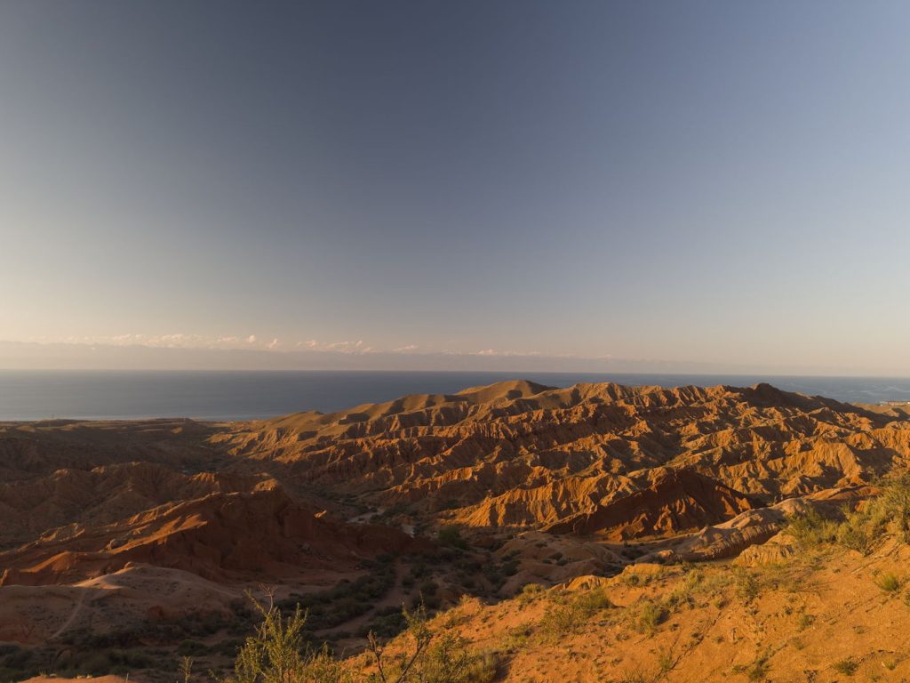
Skazka Canyon is among one of the many remote natural wonders in Kyrgyzstan that should not be missed. Walk between soaring multicolor walls – red, orange, yellow, green and purple – and scale jagged cliffs of various heights to admire the vast Issyk-Kul lake. The canyon is like an adult playground for all who wonder.
Why is it called the Fairytale Canyon?
The many colors and the unpredictable shapes of the walls are said to resemble fairytale characters – dragons and the like.
A 2025 review: is Skazka Canyon worth visiting?
Yes, but only if you will be passing between the East and West shores of Issyk-Kul Lake. The gorgeous view of the horizon on Issyk-Kul and the ability to go off trail and play around various cliff walls make this a unique natural playground. However, it will not be the biggest or grandest canyon you will experience in your life, and it can be hard to reach by public transport for a small park (~1-1.5 hours).
Getting to Skazka Canyon from Tosor
The entrance is a mere twelve minutes drive from Tosor. However, if you are taking public transport by marshrutka or hitchhiking, expect to be dropped off by the main road. This is a relatively flat but not an insignificant walk to the entrance.
Driving: drive to the main road, then turn westwards. You will reach an unpaved road, follow GPS instructions. There is parking by the entrance.
Taking public transport (marshrutka minivan) or hitchhiking:
You can wait by the Tosor bus stop (Google Maps pin, Mapy) heading westward for almost any marshrutka minivan, a form of intercity transport in Kyrgyzstan (close to every half an hour during summer season). Let the driver know you are heading to Skazka and they will drop you off accordingly. The fare will be roughly 50 KGS.
You can flag down private cars heading westward on the main road. Hitch hiking is common in Kyrgyzstan. In Kyrgyzstan, hitchhiking is signalled by hailing a car, rather than what some may know to be a hitchhiker’s thumb. If a driver slows down, let them know you are headed to Skazka and negotiate a customary hitch hiking fee (100 KGS maximum for this distance) before getting into the car.
You are likely to be dropped off on the main road, where you must hike 2.3 km (1.43 mi) with +120 m (+385 ft) along the winding road to the main entrance – this will take you approximately 45 minutes. You can probably also hitch a ride from other tourists heading in.
Do you need a ticket for Skazka Canyon?
Along the way in from the main road to the entrance is a simple ticket booth where you have to pay 50 KGS in cash per person to enter.
Slippery and sandy surface; shoes with good grip recommended
Beginner-friendly
0.9 km (0.55 mi)
+120 m (390 ft)
22 min
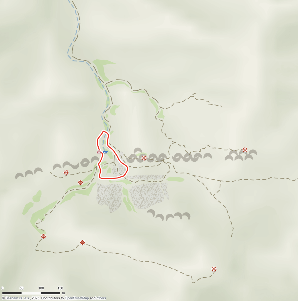
Beyond the hike from the entrance to the viewpoint, you are also at liberty to explore walking between and climbing the many canyon walls to explore a variety of other viewpoints and photo spots. You can find a variety of potential trails to follow by looking at Mapy.com, which relies on OpenStreetData – a screenshot from Mapy.com is as shown below (Sep 11, 2025).
How difficult is hiking at Skazka Canyon?
The hike is beginner-friendly – not long in distance and only steep in short segments.
How much time do you need to hike the Skazka Canyon?
See the above table to determine if you require extra time to hike in from the main road. Excluding the travel time between the main road and the entrance (45 minutes walk each way), I would recommend budgeting around 1 – 1.5 hours to explore the canyon.
What do you need to pack for Skazka Canyon?
There are microclimates around the canyon; depending on the temperature of the day of your visit, be prepared for fresh temperatures around 16 degrees Celcius. Comfortable hiking clothes and a fleece or sports jacket will suffice.
The terrain ranges from sandy to muddy; I would not visit if a rain storm is forecast due to risk of slipping. While specialized hiking shoes are not required, I would recommend shoes with good grip to prevent slipping about in the sand.
Packing list
Comfortable hiking clothes
Light sports/fleece jacket
Shoes with good grip
Offline downloaded map for navigation – there is no reception. I recommend the Kyrgyzstan map on Mapy.com app
Camera gear
Sunscreen – there is barely any shade
At least 50 KGS for each person’s ticket
Water – there are no water sources, taps or stores to get water
(Optional) A hiking pole
When is the best time to visit Skazka Canyon?
The best time of the year to visit is between Spring and Fall. Summer is the best season to visit, as spring can still hold remaining winter chills and fall brings less predictable storms.
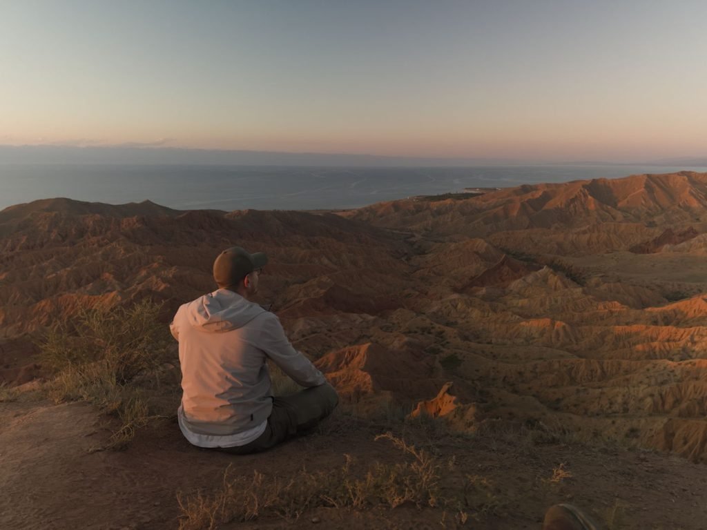
The best time of the day to visit is during sunset (1.5 hours before sunset) – the golden rays of the setting sun splayed over the jagged canyon cliffs make for a sight to behold. I visited during sunset and it was absolutely gorgeous. However, I had the good luck of meeting fellow travelers who took me along in their car. If you are traveling by public transport or hitch hiking, please budget for time uncertainty and reach the main road by 4PM.
Otherwise, the canyon is good to visit during all hours of the day. It can get hot during the peak summer months (30 degrees Celsius) in the afternoon, but nothing intolerable.
Souvenir shop and mini games at Skazka Canyon
You can buy souvenirs from Kyrgyzstan and play mini games at the small store set up by the entrance. Various Kyrgyzstani art, felt hats and other knick knacks are available for cash.
If you are feeling up for it, you can also partake in an archery minigame (10 bows) for 200 KGS per person.
Complete Spending Breakdown for Tosor and Skazka Canyon
You can expect to spend between $8 to $60 USD for a solo traveller depending on your travel preferences (budget to luxurious).
1000 – private driver (arrange with guesthouse) to/from Skazka
50 – Skazka ticket
50 – Skazka ticket
50 – Skazka ticket
200 – minigame/souvenir at Skazka
Total: 700 KGS (~8 USD)
Total: 3200 KGS (~37 USD)
Total: 5350 KGS (~60 USD)
Frequently Asked Questions
How far is Skazka Canyon from Tosor?
A 15 minutes drive from Tosor, roughly 8 km from the village center.
Can you swim in Issyk-Kul Lake at Tosor?
While the lake is not warm, many people take dips in the clear and chilled waters of Issyk-Kul Lake at Tosor. The waves are strong but not dangerous, and it is easy to warm up in the sun after a swim.
Is Tosor safe for solo travelers?
I travelled Tosor as a solo woman and can say that it is safe with caution. The village is familiar with tourists, so it was comfortable to walk about in the day and sunbathe in a swimsuit (majority of Kyrgyzstan, and Tosor, is Muslim, so you may not see local women dressed moderately). However, as night fell, the village was quiet, empty and pitch black – I would not recommend walking about alone.
Is Skazka Canyon accessible?
No, the canyon is full of sandy trails that are steep. While one can still admire the canyons by driving up to the entrance or parking area, it will be difficult for people requiring accessibility accommodations (wheelchairs, mobility aids) to hike to higher viewpoints.
The Ak Suu traverse is a multi-day trek with itineraries commonly between seven and nine days. The trek is a chain of climbing alpine passes and descending into valley floors, showcasing the beauties of Central Asia and providing the backdrop for adventurous backpacking. It is the most difficult through-hike I’ve done, but also the most rewarding and stunning.
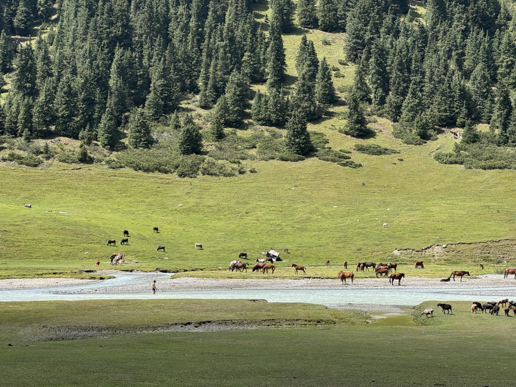
At high elevations (2800+ meters), the grass is lush and the alpine lakes are beautiful blues. Encounters with Kyrgyz nomads or shepherds, as well as grazing cows, sheep and horses are common.
As a remote location, trails were often unmarked or unclear. While this was not a technical trek, there is a lot of rock scrambling and steep terrain with loose soil and gravel. I definitely felt humbled in the face of nature.
📍 Important: This guide shows both my recommended itinerary (135km, 9 days) and what actually happened on my August 2025 trip (120km due to weather rerouting). Use the planned itinerary for your trip planning.
Ak Suu traverse difficulty rating: 4 out of 5, non-technical
Planned 9-day Ak Suu traverse specifications
Total
Daily Average*
Total
Daily Average*
Distance
135 km
16.5 km
85 mi
10.5 mi
Ascent
6920 m
865 m
22,700 ft
2,840 ft
Descent
7285 m
910 m
23,900 ft
2,990 ft
*The daily average excludes the rest day at Altyn Arashan at Day 6
**As I rerouted my trip from my planned itinerary due to forecasted rainstorms, day 8 and day 9 are estimated distance, ascent and distance from GPX plots
Elevation plot
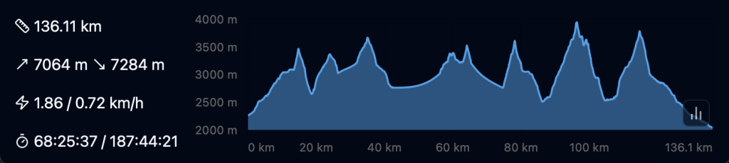
Elevation plot of planned 8 or 9-day Ak Suu traverse trek (136 km, +7065m, -7284m), excluding the rest day on Day 6.
—
In August 2025, due to a storm forecast, I modified my itinerary and walked 118km with a total ascent of 5917m, and a total descent of 6268m (see trip report at the end of post). The weather started sunny but became stormy over the last few days, with thunderstorms scattered throughout the area. As a result I made the decision to reroute and “escape” through one of the valleys on the last day.
Planning essentials
Where to buy or rent camping gear in Kyrgyzstan?
Equipment stores are rare and hard to find outside the cities of Bishkek and Karakol. Be well prepared, it is unlikely that you will be able to buy additional gear on the trail or in passing villages.
In Bishkek, you can rent gear from Trekking Union Kyrgyzstan, they also have Trekking Karakol/Jyrgalan maps available. You can buy camping gear and butane gas canisters from Sports Master or Red Fox.
Sports Master in Karakol sells butane gas canisters, gas stoves and other miscellaneous gear.
In Karakol, you can rent gear from Destination Karakol, they also have the paper Trekking Karakol/Jyrgalan maps available for sale (500 KGS as of time of writing). You can also buy ~200g butane canisters. I bought my butane canister from Sports Master for 700 KGS.
The selection is limited and it is close to impossible to find dehydrated or freeze dried camping food, water purification tablets or water filters here, so be sure to pack these essentials into Kyrgyzstan.
When is the best time of the year to hike the Ak Suu traverse?
Mid-June to August is the best time to hike the Ak Sun traverse. Any earlier and there may be remaining snow or ice at higher elevations or mountain passes. Late August or September onwards brings colder weather and snow. While I was there, there were late afternoon thunderstorms and brief snowfall (even hail) at high passes. The temperatures ranged from 28 degrees Celsius in the day at lower elevations to 2 degrees Celsius at night at higher elevations.
Should you hire a guide?
I hiked this trail solo and saw most people backpacking in pairs. This is a challenging hike that requires way finding and food supplies for the minimum length of your itinerary (7+ days), so if you are less experienced with navigation or carrying weight, consider engaging a local guide. The offices of Trekking Union Kyrgyzstan or Destination Karakol can help connect you to guides via WhatsApp.
Do you need to book accommodation in advance?
As of August 2025, there are yurts at every milestone or endpoint of each day. If you are a big group, contact Destination Karakol to guarantee and reserve yurt beds. If you are a pair or solo trekkers, you should be fine walking into yurts. I would recommend reserving beds at Altyn Arashan, which shares a stop with the popular and shorter Ala Kol trek and tends to run out of vacancies during peak season.
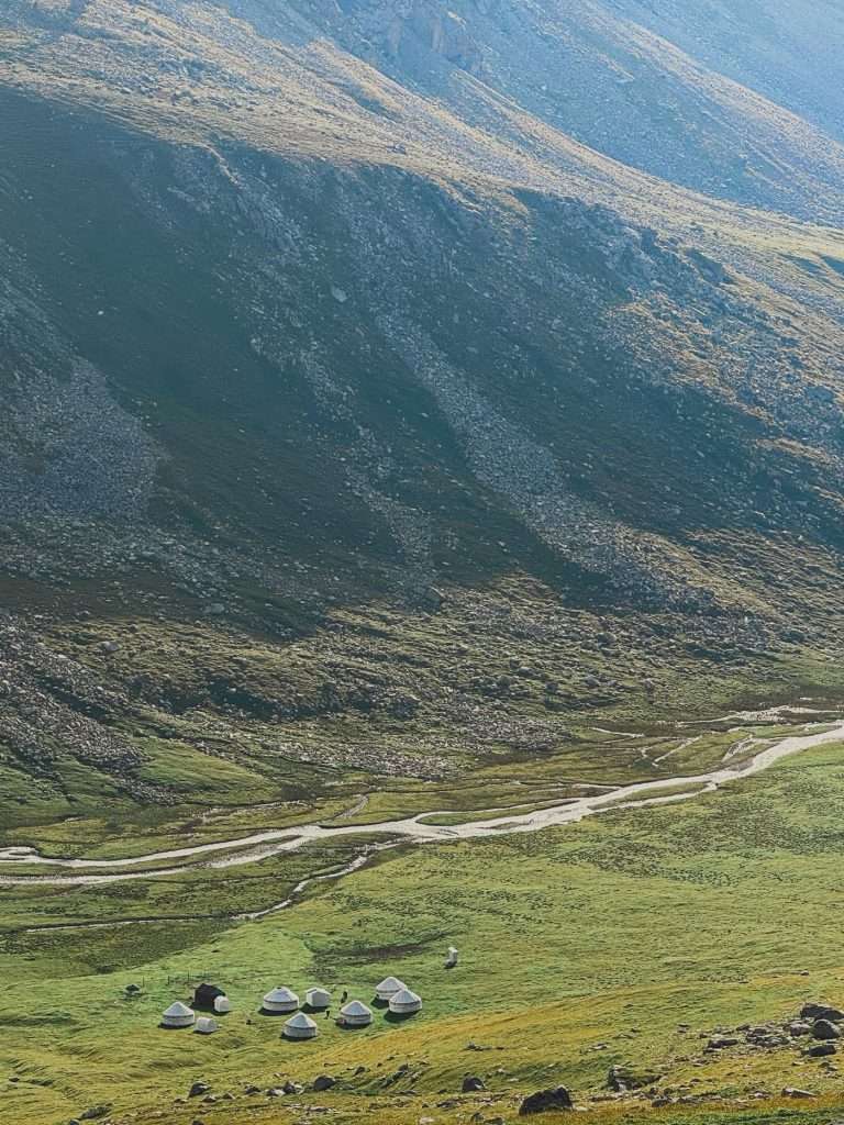
Ak Suu yurt camp offers beds and a hot dinner for hikers passing through.
Yurts and accommodation often offers breakfast, lunch or dinner for fees. Beds can range from 2500 KGS per person (or around 3500 KGS for a 2-person yurt), breakfast and lunch around 600 KGS, and dinner at 800 KGS. Food, while generous, is also simple and carb-heavy, so expect to pay more for protein options like eggs or bring your own to supplement.
Expect amenities to be basic (freestanding toilet cubicle, no showers, no WiFi and no charging) with a few exceptions in Altyn Arashan.
I tent camped most of the way, except for a rest day in Altyn Arashan where I stayed at Arashan Hotel and on the last night where I stayed at Karakol Valley’s Kyrgyz Life Yurts to avoid the overnight storm.
Is there mobile reception on trail?
Except for the first 1 km or so from Jyrgalan Valley, there will not be mobile reception on the trail. Be sure to download offline maps or bring an emergency satellite device (I never leave without my Garmin InReach mini) with you.
Where can I get food on the trail?
Before starting off, I recommend stocking up on your last supplies at the Globus supermarket in Karakol. If you missed anything, there is a small supply store in Jyrgalan and they had basic milk, chocolate, instant noodles and snacks.
On the trail, do not expect to find hiker boxes or any stores. There are yurt camps at every milestone where it is likely that you will be able to get tea and dinner.
Where can I get water on the trail?
There are plenty of water sources on the trail, with rivers and creeks flowing from glaciers and alpine lakes. However, there is also a dearth of livestock grazing and pooping around these water sources.
Hikers I met simply filtered moving water, which gets rid of most protozoan bacteria, sediment and other contaminants. For my peace of mind, I filtered and then further treated my water to eliminate potential viruses from animal poop. These viruses are smaller than filters, like my Sawyer Squeeze. They can be eliminated through boiling, water purification tablets (I carry Katadyn Micropur 1-MP for emergencies) or with a UV pen like Steripen.
Getting to the start and end
Getting to the start point of Ak Suu traverse
The trek kicks off from Jyrgalan Valley. I landed in Bishkek airport, and from there I took public buses to the Bishkek bus station.
Modes of transport
Public intercity transport, marshrutkas: these are minivans that leave on schedule or when full. You buy tickets (with additional big luggage charges) directly from drivers in cash. They usually travel along high ways, so you can let them know when you want to get off beforehand or in real time. Conversely, you can flag a marshrutka down from the side of the street to board one.
Public intercity transport, shared taxis: shared taxis leave only from bigger bus terminals (such as the Ak Tilek Bazaar in Karakol). They leave when the car is full towards a common direction. You can approach the drivers directly.
Hitchhiking: hitchhiking is common in Kyrgyzstan. You don’t use the hitchhiker’s thumb, but instead flag down cars like you would a cab. It is customary to negotiate a small cash fee with the driver with the destination before you get onto the ride. I personally did not succeed in getting a lift from another village, but I know others who have.
Ridehailing: download the Yandex Go app to call taxis without the need to haggle for price. These are only available in the bigger cities like Bishkek and Karakol and do not provide for intercity travel. Solo or female-identifying travelers can also feel safer with the Comfort or Comfort+ options when traveling late night, which is what I used in Bishkek.
Private transfers: to avoid planning uncertainty, you can also arrange for private transfers. I reached out to Destination Karakol on WhatsApp (number: +996 509 996 885) and got a quote for a transfer from Kok Jaik to Karakol. A car for 3-4 people costs 13,000 KGS (~$150 USD). A private driver from Altyn Tours costs $75-100 for the same route (feel free to contact me for their WhatsApp number).
How do you get from Bishkek to Karakol?
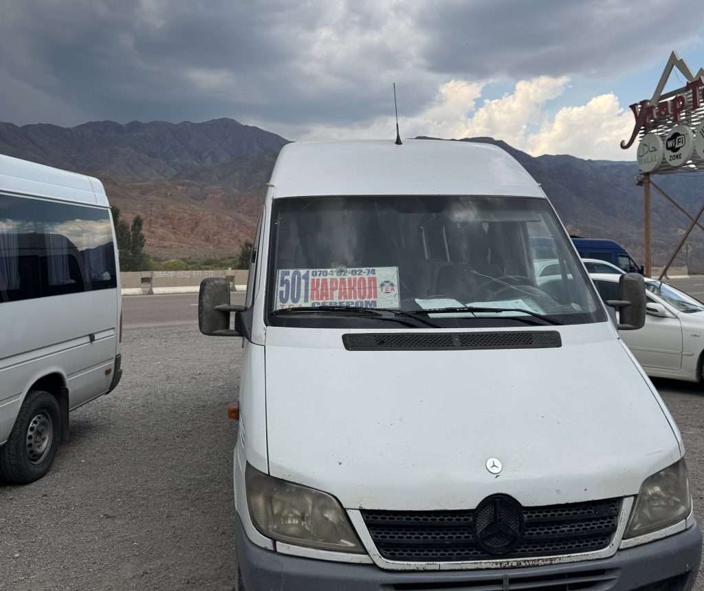
Marshrutka minivan 501 takes you from Bishkek to Karakol
You can take a marshrutka from Bishkek to Karakol. A marshrutka is a minivan form of public transport. There are a few bus stations, be sure to get to the new bus stop at Leninskoe (Yandex Map, Google Maps).
When you get to the bus station, look for the 501 minivan that says Каракол and let the driver know you want to get to Karakol. You can directly pay the driver the fare: I paid 750 KGS, which includes a big luggage fee. We waited roughly 45 minutes for the marshrutka to fill up, and the journey took me roughly ~6.5 hours.
How do you get from Karakol to Jyrgalan?
To get to Jyrgalan, you need to get to the Ak Tilek Bazaar in Karakol (Yandex Maps, Google Maps).
The marshrutka #331 to Jyrgalan leaves from there at 8.30am, 1.30pm and 5.30pm in summer. When I was there, our marshrutka ended up leaving at 2pm.
The whole ride took close to 2 hours and I paid 150 KGS for my ticket and 50KGS for my bag.
The last two stops of the marshrutka are here, right at the midpoint of Jyrgalan village, and lastly here, which is closer to most guesthouses and the start point. Be sure to check where your accomodation might be.
Returning to Karakol from the end of the Ak Suu traverse
How do you get from Jeti-Oguz to Karakol?
Your trek takes you to Jeti Oguz resort, which is 15 KM from the town of Jeti Oguz. You can take a marshrutka, hitchhike, or chat with the resort to get a ride back to Jeti Oguz. There, you can take a marshrutka back to Karakol.
How do you get from Karakol Valley to Karakol?
This is the route I took; I hiked own the valley for about 2.5 hours until I reached a bridge, where there are private taxis. I hailed a private taxi and we paid 2000 KGS for the entire car to get to Duet Hostel, which is on the southern tip of Karakol. The ride took 20 minutes.
Escape Routes on the Ak Suu traverse
if nothing should happen to you during your treks you may hike down any of the valleys towards the nearest town or village, and look for a marshrutka or hitchhike to Karakol.
Ak Suu traverse map and waypoints
I do not recommend the Discover Kyrgyzstan Karakol & Jyrgalan topographic maps as your primary form of navigation. I had a copy of these, but they are of 1:100,000 scale and had pretty fat lines for the trails that made it hard to follow.
Instead, I used a combination of the AllTrails route* and an offline map of Kyrgyzstan on the Mapy.com app. The Mapy.com app also helped plot routes to yurt camps or pins that I input. *Note: the AllTrails route leads you via the Panorama pass after Ala Kol lake, which is known to be gnarly. Hikers are advised to take the Sirota Hut route instead.
If you’d like my .GPX routes or coordinates for my campsites and the natural hot springs at Altyn Arashan, feel free to email me at weiting[at]weitingwanders.com!
Ak Suu traverse itinerary options
7-day Itinerary – experienced hikers short on time
Campsite
Distance
Ascent
Descent
Notes
Nearest yurt camp
Day 0
Jyrgalan
There are sport to camp by the river to help acclimatize to high elevation.
Many guesthouses. I stayed at Baitor Guesthouse.
Day 1
Terim Tor Buluak
15 km
838 m
122 m
Swampy and muddy land, try to follow trails on maps
Terim Tor yurt camp
Day 2
Boz Uchuk Lakes
24 km
1465 m
1214 m
Start with Terim Tor pass (3467m), followed by Boz Uchuk pass (3362m). Wide river crossing in between where bridge is washed away; there is another bridge 1 km downstream. The water reached waist level August 2025.
Boz Uchuk yurt camp, which is by Boz Uchuk river, before a climb to the lakes
Day 3
Ak Suu almaluu
18.5 km
+870 m
-1510 m
Unnamed pass (3516 m), then Alianyash Pass (3671 m)
Ak Suu yurt camp
Day 4
Altyn Arashan
15.5 km
+877 m
-1085 m
Anirtor Pass (3600m)
Many yurt camps and lodging options at Altyn Arashan
Day 5
Ala Kol
17.9 km
+1496 m
-487 m
Ala Kol pass (3960m)
Yurt camp before the steepest part of the climb to the lakes, and yurt and tent camps beside the lake
Day 6
Telety Valley
15 km
+1500 m
-1200 m
Take the Sirota Hut route to Karakol Valley, then turn left; the Panorama Pass route is known to be dangerous and gnarly. Start on the pass and reach Eco Trek camp to get a head start on the next day (5 km, +400 m)
Telety Creek yurt camp (Sirota Hut yurt camp is midpoint)
Day 7
Jeti Oguz → Karakol
24 km
+400 m
-1800 m
Climb the Telety Pass (3801 m), pass Eco Trek Camp and Kok Jaik to reach Jeti Oguz Resort. From Jeti Oguz Resort, get to Jeti Oguz village and back to Karakol.
Accomodation options at Jeti Oguz resort and Jeti Oguz town
What if I have less than 7 days to hike the Ak Suu traverse? I recommend either trimming the start or the end of the trek. You can arrange for transport directly to Boz Uchuk lakes, skipping day 1. Alternatively, you can hike from Ala Kol to Karakol valley and take private transport or hike further to Karakol town on Day 6, effectively skipping day 7. The latter is what I did to avoid hiking and camping in thunderstorms on my last two days.
[Recommended] 8-day or 9-day Itinerary – advanced or experienced hikers
I highly recommend a 9-day itinerary with a rest day in the middle to enjoy the hot springs at Altyn Arashan and rest with some hot meals. This optional rest day (day 6) can be skipped to make an 8-day itinerary.
Campsite
Distance
Ascent
Descent
Notes
Nearest yurt camp
Day 0
Jyrgalan
There are sport to camp by the river to help acclimatize to high elevation.
Many guesthouses. I stayed at Baitor Guesthouse.
Day 1
Terim Tor Buluak
15 km
838 m
122 m
Swampy and muddy land, try to follow trails on maps
Terim Tor yurt camp
Day 2
Boz Uchuk Lakes
24 km
1465 m
1214 m
Start with Terim Tor pass (3467m), followed by Boz Uchuk pass (3362m). Wide river crossing in between where bridge is washed away; there is another bridge 1 km downstream. The water reached waist level August 2025.
Boz Uchuk yurt camp, which is by Boz Uchuk river, before a climb to the lakes
Day 3
Alianyash Lakes
7 km
620 m
578 m
Unnamed pass (3516 m)
Jergez yurt camp, which is in the valley before Alianyash lakes
Day 4
Ak Suu almaluu
Alianyash Pass (3671 m)
Ak Suu yurt camp
Day 5
Altyn Arashan
15.5 km
+877 m
-1085 m
Anirtor Pass (3600m)
Many yurt camps and lodging options at Altyn Arashan
Day 6
Optional rest day at Altyn Arashan
Natural hot springs are 30 minutes walk down the valley from Arashan Hotel
Many yurt camps and lodging options at Altyn Arashan
Day 7
Ala Kol
17.9 km
+1496 m
-487 m
Ala Kol pass (3960m)
Yurt camp before the steepest part of the climb to the lakes, and yurt and tent camps beside the lake
Day 8
Telety Valley
15 km
+1500 m
-1200 m
Take the Sirota Hut route to Karakol Valley, then turn left; the Panorama Pass route is known to be dangerous and gnarly. Start on the pass and reach Eco Trek camp to get a head start on the next day (5 km, +400 m)
Telety Creek yurt camp (Sirota Hut yurt camp is midpoint)
Day 9
Jeti Oguz → Karakol
24 km
+400 m
-1800 m
Climb the Telety Pass (3801 m), pass Eco Trek Camp and Kok Jaik to reach Jeti Oguz Resort. From Jeti Oguz Resort, get to Jeti Oguz village and back to Karakol.
Accomodation options at Jeti Oguz resort and Jeti Oguz town
Alternatives:
Skip the Day 6 rest day for a day of side quests around Alianyash Lakes
Have an extra day? Make it a 10-day itinerary by exploring the Alianyash lakes.
After day 3 at the Alianyash Lakes, take an extra day to explore the side trails around Alianyash Lakes. These are roughly 5 km one way.
My Actual 2025 Trip Report (Weather-Modified Route)
For my actual trip in August 2025, I rerouted Day 8 and Day 9 from Ala Kol → Telety Valley → Jeti Oguz Resort to Ala Kol → Karakol Valley → Karakol River due to forecasted heavy and persistent thunderstorms.
Actual trip (reroute Day 8/9 to Karakol Valley → Karakol River, skipping one more pass)
Total
Daily Average*
Total
Daily Average*
Distance
120 km
14.5 km
73.5 mi
9.0 mi
Ascent
5920 m
730 m
19,410 ft
2,390 ft
Descent
6270 m
770 m
20,571 ft
2,526 ft
Elevation plot of weather-modified actual 9-day itinerary
(Optional) Day 0 Warm up: Jyrgalan
To warm up, I walked 7km along the start of the trail with my pack. I practiced flying my drone, and took notes of how well marked the trail is. It was my last chance to test my navigation system. The night in Jyrgalan (2800m above sea level) also helped me acclimatize to higher elevations.
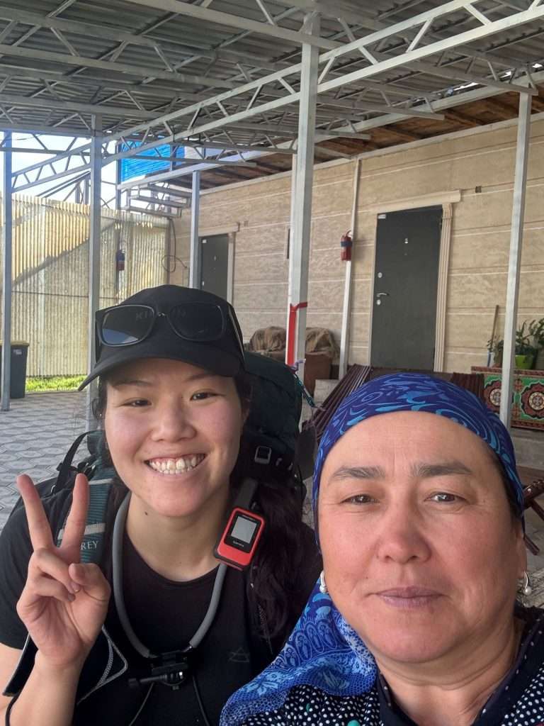
A selfie with my host at Baitor Guesthouse, Jyrgalan before setting off. Thanks Bermet!
Day 1: Jyrgalan → Terim Tor Buluak
Distance: 15.1 KM, +838m, -122m
Time: 8 hours
Moving time: 5-6 hours
Notes: I took my time with the first day, taking in the scenery and a lot of shots.
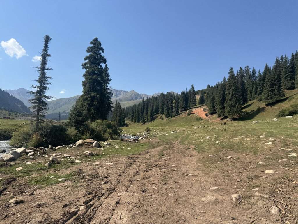
The start of the Ak Suu traverse follows the Jyrgalan river
From the village, cross the river and walk along its west shore. The terrain is gentle and flat, the river a calming gush in the background. Watch your steps because it can be muddy, I sank one of my legs up to my knee in mud.
Soon, you will arrive on a jeep road and begin a gradual ascend.
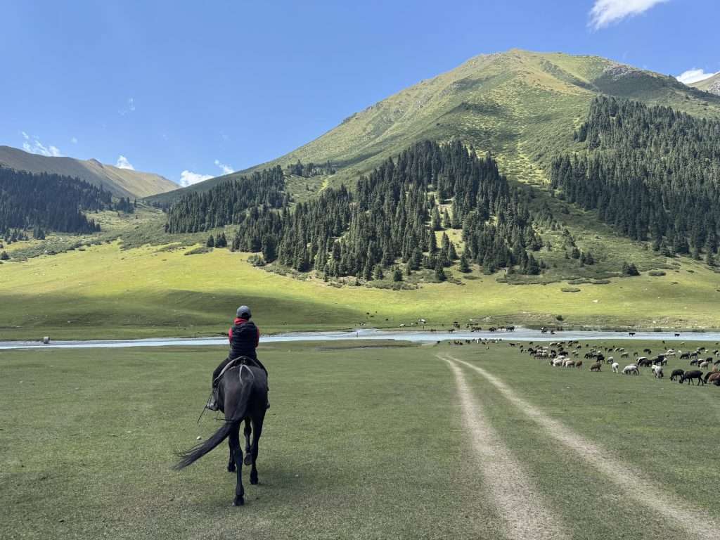
Along the way, I came across a few seasonal nomads and grazing horses, even two young brother-shepherds.
After climbing a small hill, you will descend onto a meadow that is 99% bog and 1% land. Follow the marked trail on the apps around the perimeter, no matter how tempting it might be to walk across.
You will finally pass Jyrgalan yurt camp. Follow along the river for roughly half an hour more and you will find flat (but marshy) camping spots at the foot of Terim Tor pass.
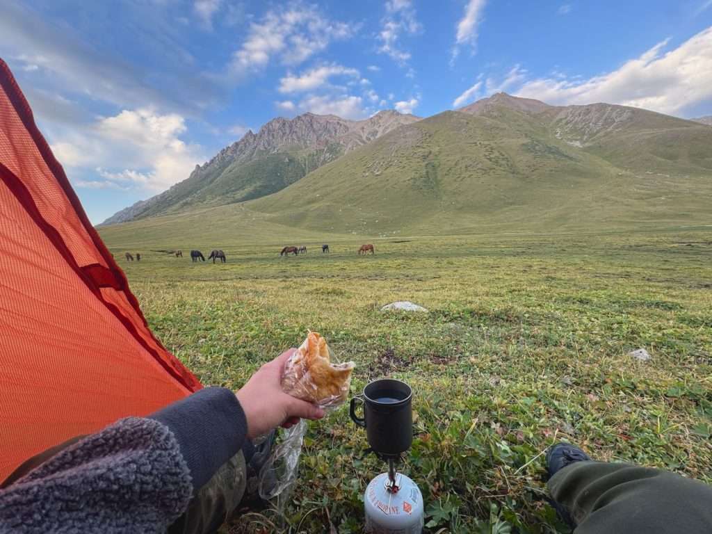
Ending the day with my packed samsa for dinner in my tent, with a view of grazing horses in the background.
Day 2: Terim Tor Buluak → Boz Uchuk river
Distance: 17 KM, +1065m, -1214m
Time: 10.5 hours
Moving time: 7.5 hours
Notes: I had not acclimated to the high elevation and hiked slower than usual. Also, the descend from the second pass is less than straightforward, without a clear trail and requires wayfinding around tough shrubs and over rocks. As a result I did not reach Boz Uchuk lakes, but camped by Boz Uchuk river half an hour to sunset. The planned itinerary would add 7.4 km (+400m) and 1.5-2 hours climb from the river to the lakes. To my understanding, most people camped by Boz Uchuk yurt camp and started the climb the next day; Boz Uchuk yurt camp is 1 hour from the lakes.
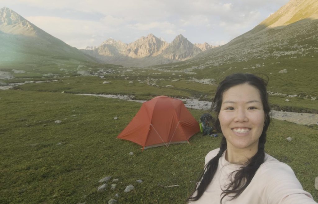
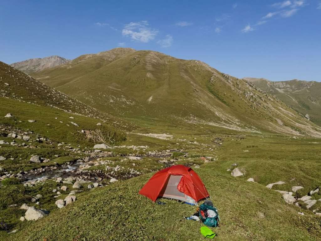
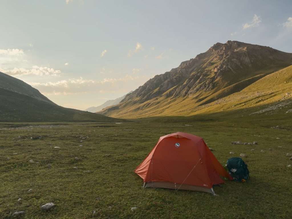
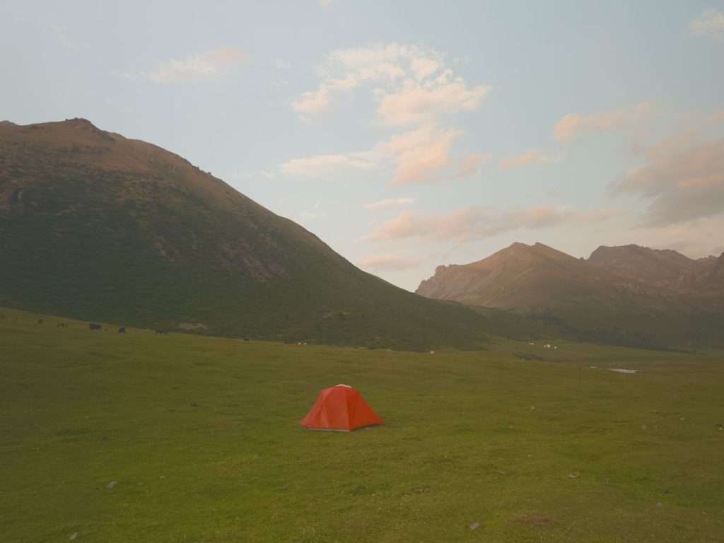
Camping by Boz Uchuk river, before the Boz Uchuk Lakes on the Ak Suu traverse
Day 2 is the second most strenuous day, with two separate passes and a wide river crossing.
Start with climbing Terim Tor pass (3467 m). The trail may not be obvious, but try to follow the marked trail lines on the apps as closely as possible as dispersed rocks and uneven grass will present themselves midway. That caused me quite a bit of detour to go around the rocks.
The first pass of the trek presents views that hold no candle to subsequent ones, but is still breathtaking.
Admire the view of Jyrgalan valley from the top of the first pass, Terim Tor Pass.
Descend downwards until you reach a river crossing. Here, you can take some time for a lunch break with the view, or continue onwards and take a break after crossing the river.
The bridge marked on the trekking maps has been washed away, however, I heard there is an alternative bridge around 1 km downstream. Otherwise, you can cross the river by foot (with proper precautions) – the water reached up to waist level depending on your height.
Alternatively, you pay this entrepreneurial 8-year-old boy to cross the river on horseback. He was hustling hard and I have to admit I have a soft spot for kids, so I paid him 1000 KGS to take me across. This was too much, I even heard of groups negotiating a bulk deal for 350 KGS per person, but after hesitating for 15 minutes I definitely lost my negotiating power.
An entrepreneurial boy will offer to take you across the river on horseback for 1000 KGS. The river was up to waist level when I was crossing. Some hikers crossed on foot.
After crossing the river, you make another climb for Boz Uchuk Pass (3362 m). This time, the descend is steep and there is close to no trail. With shrubs galore, I had to find my way down to the next river. Keep an eye out for a turn to the left, the trail is not evident but is marked on the map.
There is another climb past the Boz Uchuk yurt camp to the Boz Uchuk lakes.
I underestimated the time it would take to get to the lakes, and set up camp at the foot of the climb. That was a good call because the climb to the lakes was strenuous and required scrambling over rocks. However, I got to the Boz Uchuk lakes for lunch the next day and they were absolutely gorgeous.
There are two of the lakes, both gorgeous. As I had the lakes to myself that afternoon, I enjoyed the solitude and took a dip.
Day 3: Boz Uchuk River → Jergez Valley
Distance: 12.4 KM, +741m, -578m
Time: 8.5 hours
Moving time: 6.5 hours
Notes: I camped at Jergez Valley before Alianyash lakes, rather than by the lakes themselves. This gave me the opportunity to recover from the late night I had before. The climb to Alianyash lakes would be a further 2.5 km and +280 m.
Enjoying the Boz Uchuk Lakes in solitude
From the Boz Uchuk lakes, you follow along the slope of the mountains to another pass (3516 m). You can either follow the trail marked on the maps, which takes you uphill but is more straightforward, or you can follow along the contour line (at the same elevation) like I did and scramble over multiple rounds of rocks. Pick your adventure, I guess.
After the pass, you descend down into Jergez Valley. This is where I set up camp, and you can choose to do the same.
Jergez Yurt Camp in Jergez Valley is visible as you descend down the Alianyash PassI set up camp by the water in Jergez Valley, further past the yurt camp
Alternatively, you can ascend to Alianyash Lakes. I found Alianyash Lakes to be quaint but underwhelming in comparison to the Boz Uchuk lakes. There are campsites around both of the alpine lakes and the trail takes you between the two of them.
Day 4: Jergez Valley → Ak Suu Almaluu (Ak Suu Valley)
Distance: 14 km, +498m, -934m
Time: 6 hours
Moving time: 5 hours
Notes: I caught up to the planned itinerary today, passing by Alianyash Lakes first thing in the morning.
The Alianyash lakes are beautiful. The variety of small trails around the area presents opportunities for adventure.
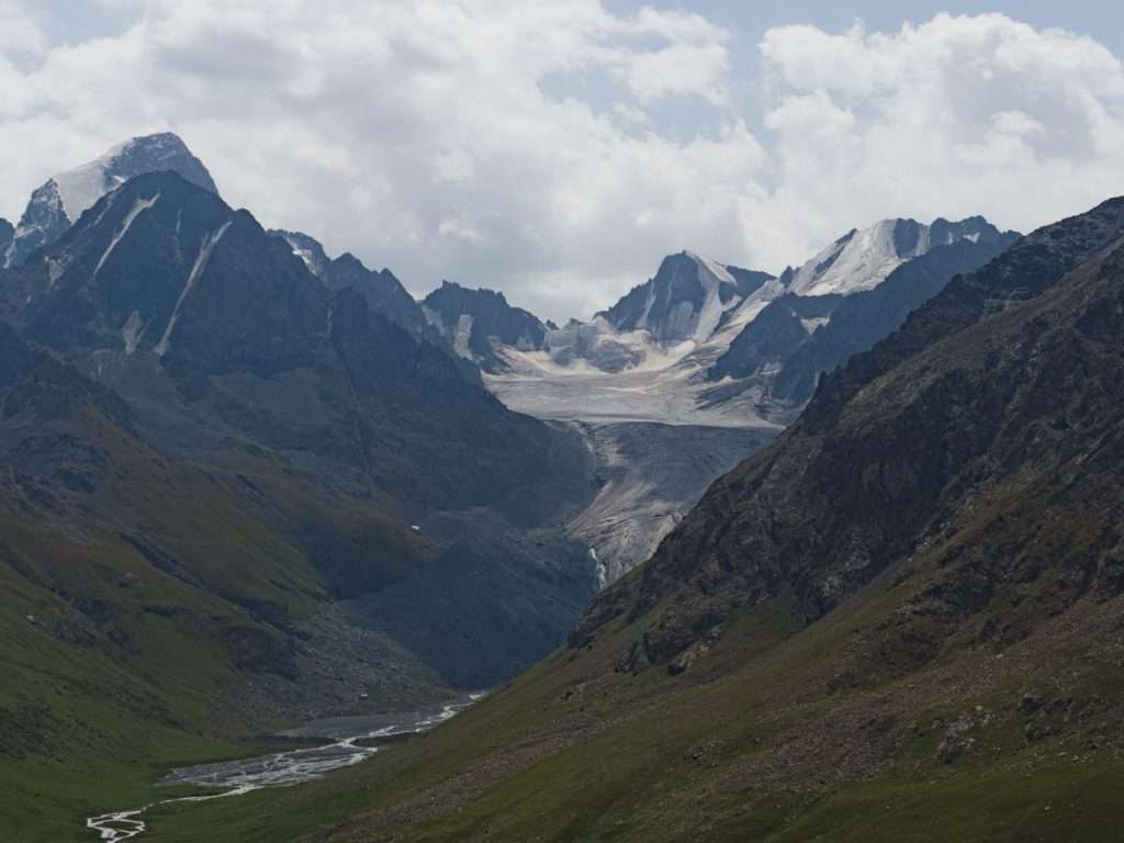
After the lakes is Alianyash pass (3671 m), a further climb. The view at the top of the climb however, is gorgeous – this is where you get your first peek of the glaciers in the region.
The Tashtambek Tor Bashi glacier (4463 m) can be admired from Alianyash pass.
After Alianyash pass, you descend down into Ak Suu almaluu, a quaint and remote valley.
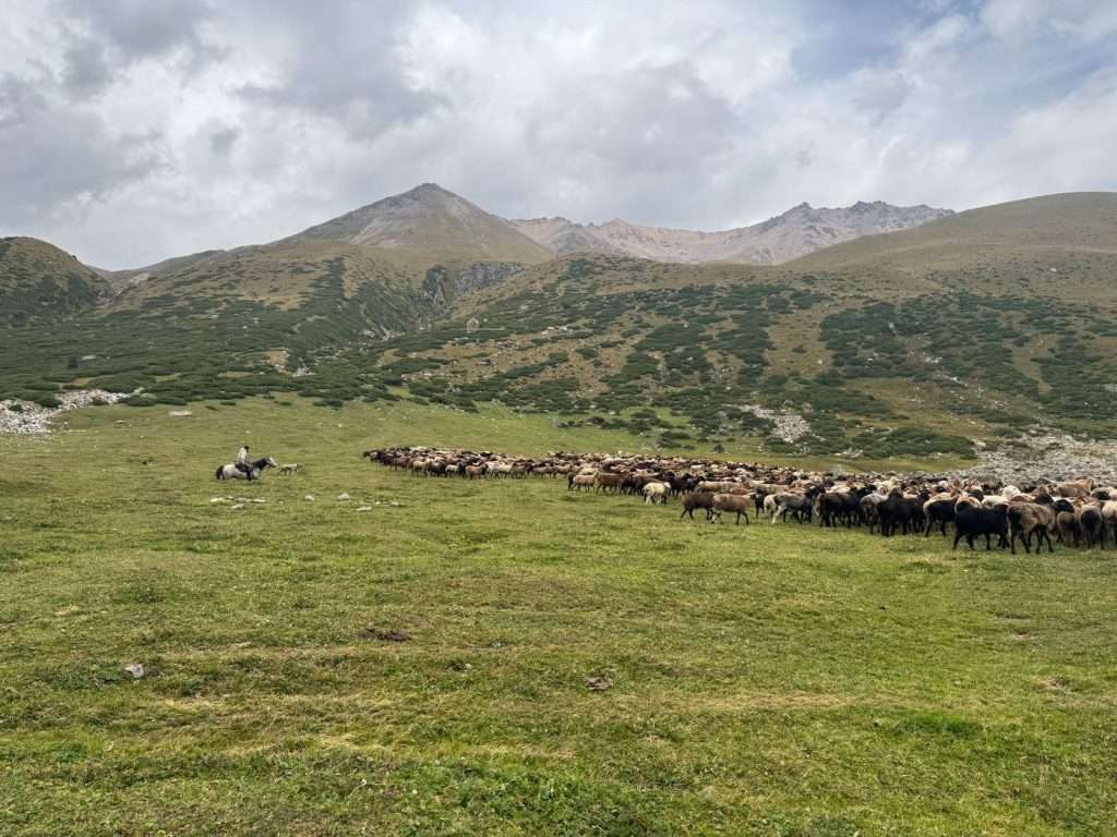
I had an encounter with a herd of sheep on the way, and after greeting the shepherd and having a short conversation with him, he signaled for me to follow behind him and he “parted” the sea of sheep for me. It was a surreal experience.
A shepherd guides his herd of sheep to the side, allowing me to cross the field.
The descent down the valley is gradual. This is one of the shorter days. After following parallel animal tracks down the valley, you will eventually come to Ak Suu yurt camp.
Continue on your way for approximately 20 minutes, and you will reach Ak Suu river. There are campsites by this river where you can hunker down and enjoy the company of grazing livestock with the earlier day’s end.
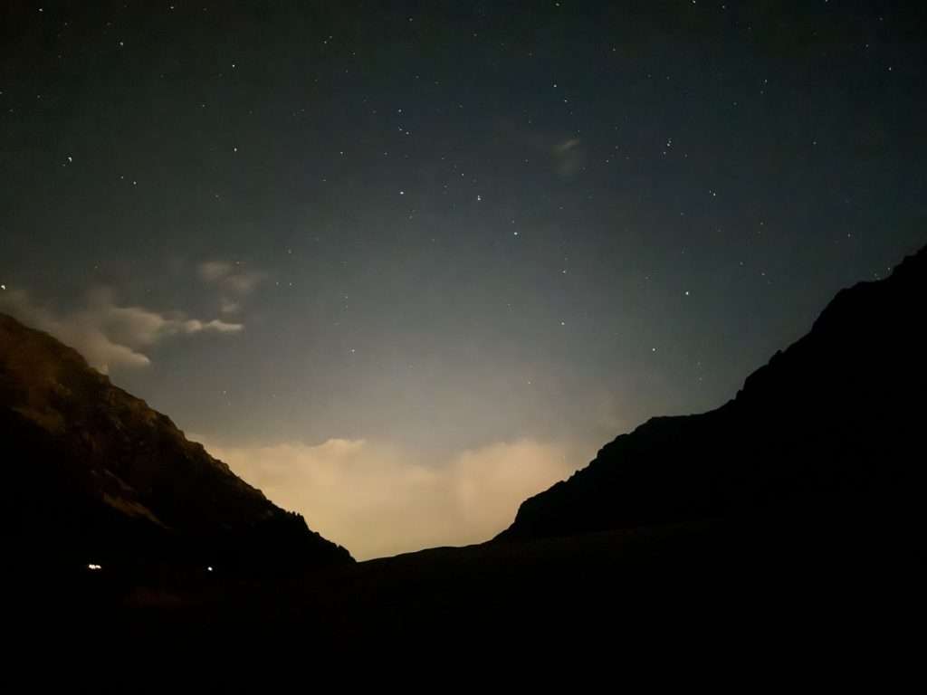
Set up camp at Ak Suu valleyStars shone brightly before moonrise
Day 5: Ak Suu Almaluu → Altyn Arashan
Distance: 15.5 km, +877m, -1058m
Time: 6.5 hours
Moving time: 5.5 hours
The bridge across Ak Suu river is only the beginning of a long ascend up another pass.
The day starts with another climb towards Anirtor Pass (3600 m). Follow the river to cross a bridge, then look for an opening in the trees which leads to the trail. The shepherd kindly pointed the way out to me after I greeted him, probably because I looked lost, but that saved me a ton of time.
The trail takes you through forest cover, although there are parts where you cross ravines, so once again look out for the trail on the map.
The last part of the climb is steep, but the switchbacks help manage the loose rocks. The view at the top, however, is absolutely stunning.
Look behind you at the valley, and look forward to a range of mountains. Absolutely gorgeous.
The descend almost makes you pay for the view. It is steep with a lot of loose rock, and the view of the grassy valley continuously teases you from ahead. Once you reach it however, it is a gradual descend with plenty of flat terrain, walking beside grazing horses and cows until you reach Altyn Arashan.
There are plenty of yurt camps and accommodations at Altyn Arashan. I had lunch for 800 KGS at Ernis Eco Yurt Camp – this is the first yurt camp you see, and comedically I was so hungry. It was a three course meal with soup, salad, and a main dish with free flow tea.
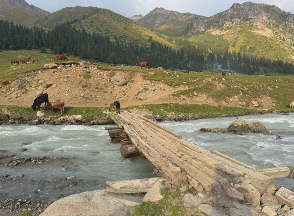
Descending further into the valley, you can set up your tent by the river and inform any yurt camps or accommodation of your desire to join for dinner.
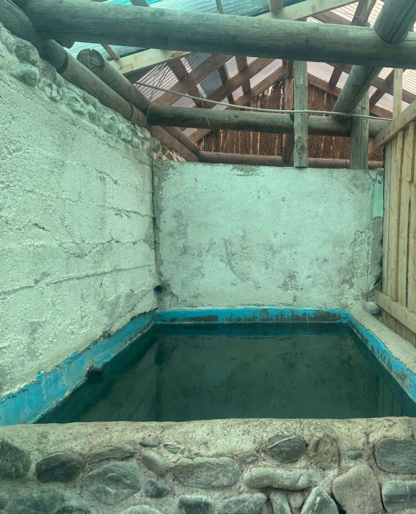
I chose to hunker down in a dorm room at Arashan Hotel, where for 1500 KGS, I had a bed, access to their private hot springs, breakfast in the morning, and a shared toilet.
Guests take turns to use the private hot spring at Arashan Hotel. This is just one of many of their facilities.
Day 6: Rest day at Altyn Arashan
I took a day to rest, avoid an impending rainstorm, mingle with other travelers, and recharge my devices. I was also excited to explore for natural hot springs.
Altyn Arashan is known for their hot springs. However, these hot springs are not as easily accessible as one would expect. In the valley-town itself, you have to pay or stay at specific accommodations to access their hot springs: ELZA guesthouse and Arashan hotel are examples of where you can access hot springs.
You can also find natural hot springs at Altyn Arashan, which is what I did on my rest day. An half an hour hike down the valley in this direction brings you to the natural hot springs.
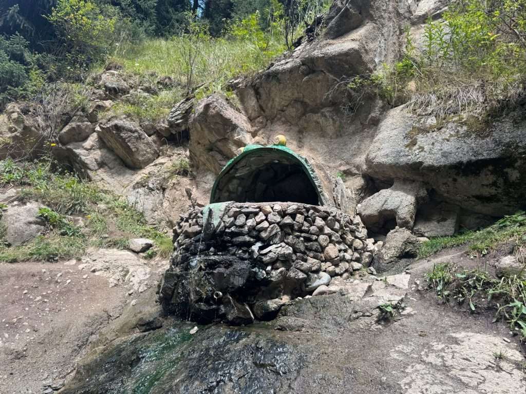
These hot springs are by the river and really surprised me; they are not that “natural” and are quite small. One of them was in a shape of a frog with a crown – that is the one I enjoyed in the company of friends I made along the way.
The natural hot spring at Altyn Arashan flows into a king frog bath.
The temperature of the water was lukewarm at best, leaving me disappointed. The hot springs at Arashan hotel were much cleaner and hotter.
While it is an experience, it seems like it might be a gamble. Another group of friends who visited after me even said that the hot springs stopped flowing, and there was barely any water to take a dip in when they visited.
I spent a bulk of my time in Arashan hotel’s restaurant, where a Starlink connection provided WiFi to call my loved ones. I also played a game of chess, which I really enjoyed.
Day 7: Altyn Arashan → Ala Kol
Distance: 17.9 km, +1496 m, -487 m
Time: 10.5 hours
Moving time: 9 hours
Take a selfie with the Ala Kol Pass sign and the lake!
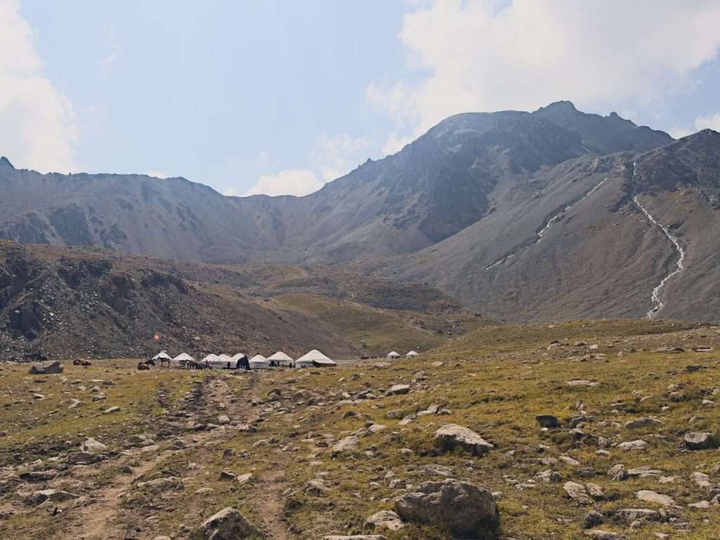
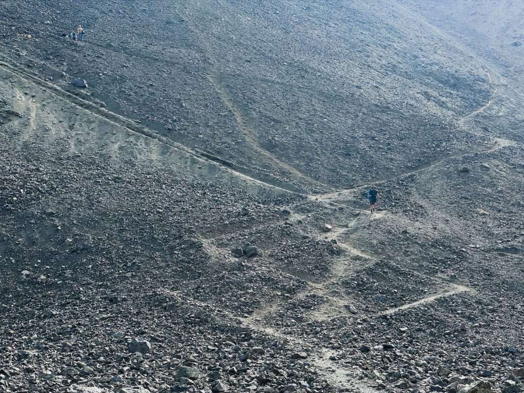
This is by far, the most strenuous day. Set off in the morning by crossing the river and heading up the valley. The climb is gradual for 95% of the way until you reach Ala Kol yurt camp. Here, the remaining 5% of the way is a steep climb with loose gravel. By holding your breath and following the switchbacks, you’ll soon reach Ala Kol pass, where the view will take your breath away.
There is a yurt camp before the final steep climb.The last bit of the climb is steep and full of loose stones. Follow a switchback for ease.
Look to your left and you see the amazing glaciers that gush into Ala Kol lake. Look downwards and you see the beautiful teal-blue alpine Ala Kol lake.
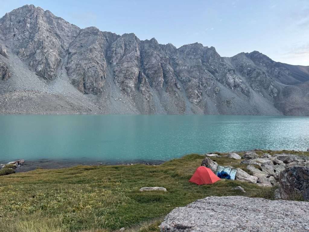
Take a moment to enjoy the view, then begin your descend with caution. There is plenty of loose rocks and steep trails here. Look out for gently formed switchbacks towards the shore of the lake if you want to camp by the lake, which is what I did, but be ready for a lot of sliding and rock scrambling.
The glaciers as seen from Ala Kol Pass are breathtaking.
The alternative is to follow the trail, which continues to take you uphill, until you reach the campsites overlooking the lake. These are on higher ground, but a 10 minute walk takes you to the shore of the lake.
There are two campsites by the exit end of the lake, a tent site and a yurt site.
My campsite by Ala-Kol lake. The turquoise blue was mesmerizing.
Day 8: Ala Kol → Karakol Valley
Distance: 13 km, +251m, -1266m
Time: 7 hours
Moving time: 6 hours
Notes: I followed an incorrect trail and overshoot the bridge to the yurt camps, adding 0.5 km and 1 hour to my hiking time
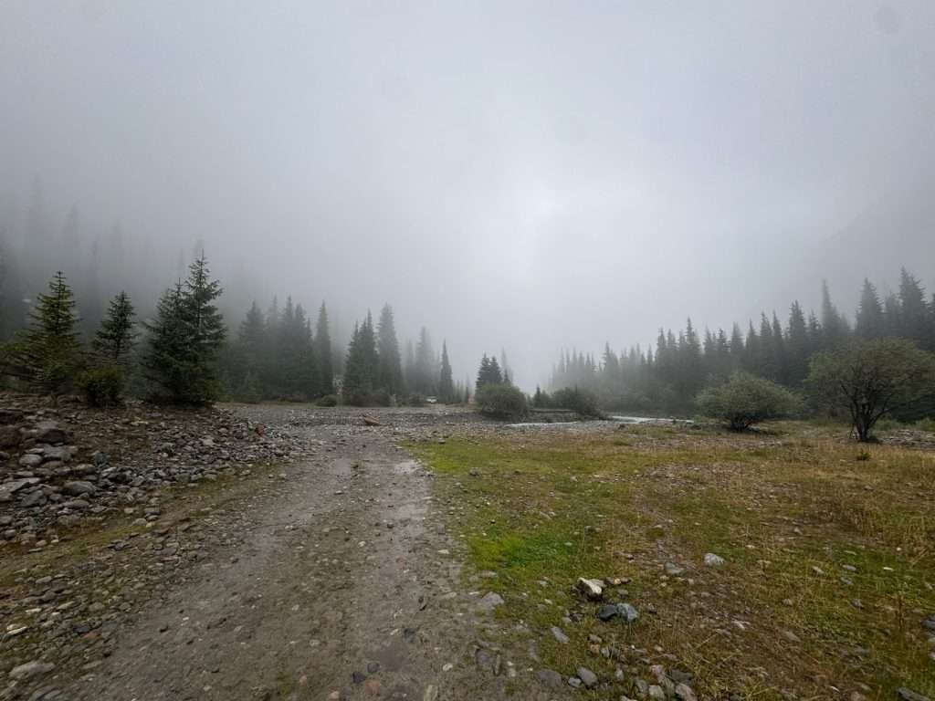
The rainstorms were forecasted to continue, causing me to modify my route. However, the fog was poetic at Karakol Valley.
From my campsite by the lake, I followed a trail to the tent campsites, then continued on.
The journey from Altyn Arashan to Ala Kol overlaps with popular shorter hiking itineraries to see the lake, so expect to see heavy traffic during peak seasons.
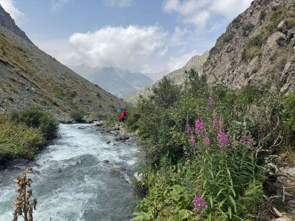
The descend, while steep and laden with loose rocks, gives you beautiful views of two waterfalls from the lake. As you complete a majority of the descent, you will walk along the gushing river between beautiful shrubs and colorful flowers. This is a great place for some solitude and lunch if you desire.
The trail from Ala Kol Lake follows a gushing river. Flowers and greenery line the shore.
Continue your trek downwards. A portion of the trail requires rock scrambling, but roughly follow the marked trail on the map apps or look out for spray painted red arrows on rocks to emerge onto ground again. You will soon pass by a cluster of yurt camps, including the popular Sirota Hut yurt camp. These yurt camps may even have shops; I bought a soft drink from one of them.
As I continued on, I headed into a forested terrain and finally crossed Karakol river, ending up in Karakol Valley.
With a heart longing for just a night more in nature, I decided to stay at the Kyrgyz Life yurt camp. There is space to set up tents by the river, but there was a forecasted thunderstorm and I did not want to return to Karakol with wet gear.
I shared my yurt with a fellow traveller; we paid 3500 KGS for a yurt with two beds. I was quoted a single bed for 2000 KGS beforehand. My dinner was 750 KGS, and it was a three-course meal with bread, salad, and a instant food version of Beshbarmak. It was a little bare, but the yurt camp had wifi in the common area and a shop.
Day 9: Karakol Valley to Karakol
Distance: 11 KM, +49m, -506m
Time: 3.5 hours
Moving time: 2.5 hours hiking + 20 minutes taxi
Notes: The full walk is 25km, which is the standard across all routes down valleys to the nearest village. It is entirely downhill, which I estimate would take around 6 hours of walking.
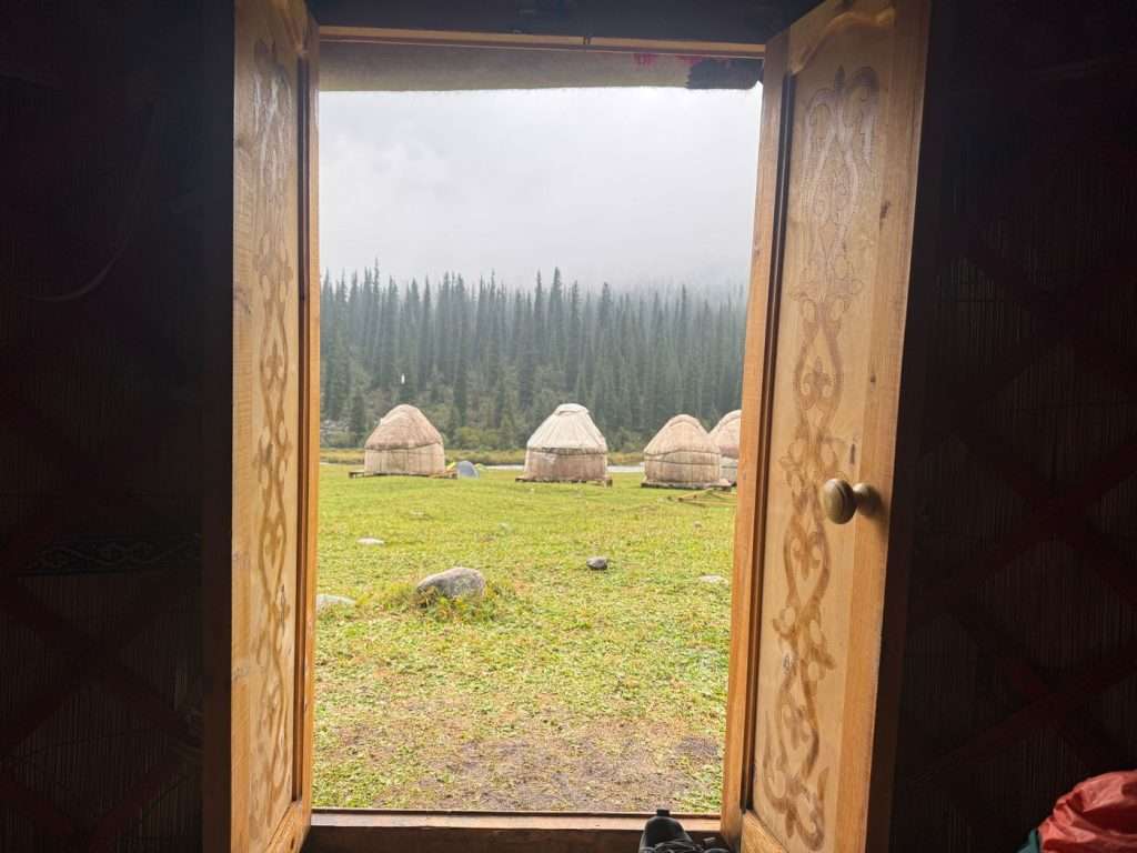
I stayed in a yurt in Karakol Valley, sheltering from overnight and morning thunderstorms.
Thankfully, the thunderstorms passed overnight, leaving us with rain showers in the morning and afternoon. After contemplating our way back to Karakol over breakfast – 8000 KGS for a private car or trekking an estimated 7 hours towards the city – we decided to trek.
This was a heavily trafficked route in the other direction, as it overlaps with the first day of the Ala Kol Lake hike. The rain showers brought out a beautiful smell among the pine trees but made the route slippery and muddy – trail shoes with good grip were helpful here.
After 2.5 hours of walking along the jeep road, we came along the first of two bridges crossing the Karakol river, where we made a wish. My companion and I found a horse shoe along the way. In his Polish customs, he believed that by throwing the horseshoe into the river, we could make a wish. I wished for good health and wealth.
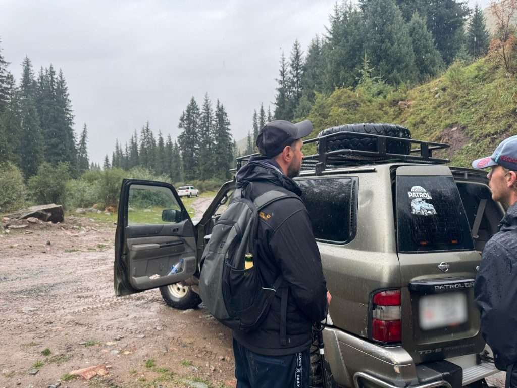
By the bridge, a shared taxi driver had just dropped someone off. We negotiated a fare of 2000 KGS with him to take five drenched hikers to Duet Hostel, which is the southern end of Karakol. The ride was approximately 20 minutes, and the Kyrgyz music playing with the patter of the rain on the car set a melancholic but poetic backdrop to the end of my trek.
A shared taxi driver was at the Karakol River bridge, offering 2000 KGS for the entire car to Duet Hostel in Karakol town.
What to pack for trekking in Kyrgyzstan?
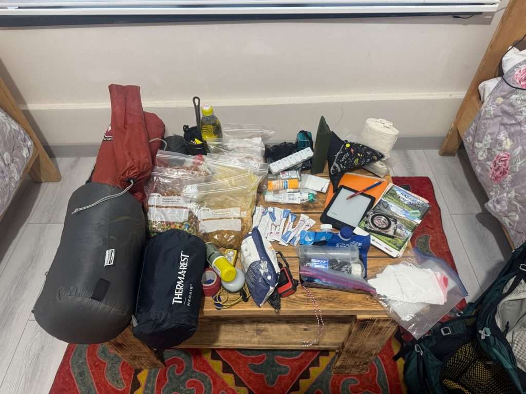
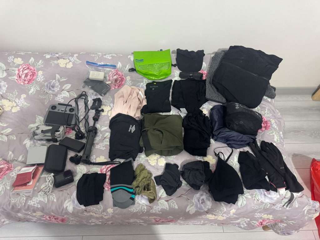
My shelter and sleeping system, dehydrated foods, toiletries, map/compass, Kobo e-reader, journal.My emergency contact info (printed), clothes, camera gear, power bank.
The weather and as a result, terrain, on this trek is unpredictable and can get wet and cold. I would advise anyone to bring layers and rain gear to stay safe in the mountains.
Additionally, the majority of the trek aside from the Altyn Arashan to Ala Kol lake segment is remote with low foot traffic. One should be prepared for emergency situations.
Must-have gear and items
Backpack
Waterproof backpack liner – I use a simple plastic bag
Shelter and sleep systems
3 season sleeping bag or quilt
3 season sleeping pad
Tent: I do not recommend a hammock, as majority of the campsites had little trees around
Clothing and layers
Hiking shirt and pants (ideally UPF rated)
Extra set of shirt and pants – lightweight
Hat or cap
Sunglasses
Thermal top and bottoms – temperatures dropped down to 2 degrees while I was there
Two sets of underwear
Three pairs of hiking socks – I use layers of merino wool Jinji sock liners under Darntough hiking socks to mitigate blisters and toes rubbing
Lightweight down jacket
Lightweight fleece jacket
Rain poncho with hiking backpack cover
Navigation and safety
Offline map of Ak Suu traverse on All Trails downloaded
Satellite device – I used my Garmin InReach Mini 3 to keep my loved ones updated and get weather forecasts
(Optional) Compass and trekking map of Jyrgalan/Karakol – I do not recommend using this as a primary method of navigation as the map scale of 1:100000 is not conducive to seeing trail details. It only gives you a general direction.
Cooking and water
Water filter – Sawyer water filter
Water treatment – Steripen or Katadyn Micropur tablets
Cooking system – Soto Amicus camping stove with ignition
Butane gas tank
Cooking utensils – I brought only my MSR camping cup and an MSR camping spoon, because my food only required boiled water
Food (at your own discretion and itinerary)
12 packs of dehydrated food: breakfast and dinner excluding start, end, and rest days
1.5kg of custom trail mix
500ml of olive oil which I poured into a plastic bottle, to help with calories
Hygiene and toiletries
Biodegradable soap
Toothbrush
Toothpaste
Shovel to dig catholes
Toilet paper
Stick sunscreen
(If applicable) Disposable contact lenses and glasses
(If applicable) Daily medication or supplements
First aid kit – should include a tick tweezer, and leukotape or blister tape. I also used alcohol wipes and plasters for small cuts.
Electronics
Smartphone – for navigation
Powerbank
Headlamp
Optional gear
Electronics
Backup powerbank
Camera – I brought my waterproof DJI Osmo Action 5 and a DJI Mini Pro 4 drone, with corresponding batteries
Waterproof socks or waterproof shoes – I highly recommend waterproof socks for unavoidable creek and river crossings. Most people will recommend Goretex or waterproof shoes, but I dislike those as they trap water and keep my feet wrinkled and cold.
Dry bag for laundry – I use a Scrubba mini bag for laundering my socks and underwear with soap. It was also helpful in keeping my electronics dry in the rain.
Trekking poles (recommended) – to each their own, but I found walking with four “feet” helped me keep my balance on especially steep terrain
Gloves and warm hat (recommended) – it was storming and raining during the later half of my trek. I was very grateful for my gloves and hat. I even had a friend ask if I might have a spare pair of gloves because it was so cold.
Lightweight rope – I use Dyneema rope for emergencies, repair, clothes line etc.
Meal plan for Ak Suu traverse
I packed 12 dehydrated meals, a 500ml bottle of olive oil (poured into a plastic bottle) and 1.5 kg of my own trail mix.
Breakfast
Lunch
Dinner
Day 0
Lodge/town
Lodge/town
Lodge/town
Day 1
Lodge
Fresh packed
Fresh packed
Day 2
Dehydrated meal
Trail mix
Dehydrated meal
Day 3
Dehydrated meal
Trail mix
Dehydrated meal
Day 4
Dehydrated meal
Trail mix
Dehydrated meal
Day 5
Dehydrated meal
Lodge
Lodge
Day 6
Lodge
Lodge
Lodge
Day 7
Lodge
Trail mix
Dehydrated meal
Day 8
Dehydrated meal
Trail mix
Dehydrated meal
Day 9
Dehydrated meal
Lodge/town
Lodge/town
How much does it cost to hike the Ak Suu traverse?
The below is what I spent on my Ak Suu traverse trip, including my arrival day at Karakol and a Day 0 at Jyrgalan. You should expect to spend between $130 (budget) to $485 (yurt-to-yurt) for a 9-day itinerary.
Gear: I did not buy any gear as I brought my own. I did buy a butane gas cannister.
Food: Most of my meals on trail were pre-packed dehydrated meals and trail mix, unless specified. I ate or packed warm meals at the start, middle (at Altyn Arashan) and end of my trip. You can find me meal plan below.
Yurt costs: Yurts usually cost between 2500 – 3500 KGS for a bed and hot tea, ~850 KGS for dinner, ~650 KGS for breakfast and lunch. All yurts, aside from at Altyn Arashan, have shared toilets and no showers. (As of Sept 2025)
Karakol national park fee: You may have to pay this 300 KGS tariff after crossing the Karakol river bridge. A park ranger may approach you, and you can say that you entered the park from the other side.
Day
Item
Full yurt-to-yurt
Mixed tent/lodge camping
Full tent camping
Arrival day
eSIM
500
500
500
Marshrutka from Bishkek to Karakol
750
750
750
Map of Karakol & Jyrgalan trekking
500
500
0 (mobile apps)
Gas cannister ~220g
N/A
700
700
Groceries for trek (nuts, raisins, milk, chocolate, olive oil)
1700
1700
1700
Karakol lodging (incl. breakfast)
4785
4785
1250
Dinner in town
315
315
315
Day 0
Marshrutka from Karakol to Jyrgalan
200
200
200
Lunch in town
315
145
145
Jyrgalan lodging (incl. breakfast)
3900
3900
0 (tent)
Dinner at lodge
800
800
800
Day 1
Packed lunch for day 1 of trek
400
400
400
Day 2
River crossing tip for boy on horseback
1000
1000
0 (cross on foot)
Day 3
Yurt camp + breakfast + dinner
5000
0
0
Day 4
Yurt camp + breakfast + dinner
5000
Day 5
Lunch at lodge
800
800
Altyn Arashan lodging (incl. breakfast, hot springs)
4500
1500
0 (tent)
Arashan Hotel / Kyrgyz Life WiFi
200
100
100
Dinner at lodge
950
950
950
Day 6 (rest day)
Altyn Arashan lodging (incl. breakfast, hot springs)
4500
1500
0 (tent)
Dinner at lodge
950
900
900
Day 8
Karakol Valley yurt bed
2500
1750
0 (tent)
Karakol national park fee
300
300
300
Dinner at lodge
800
750
0
Treats at shop by Karakol river (beer and a banana)
500
500
0
Day 9
Private driver from Karakol bridge to Karakol (2000 for one taxi)
2000
400 (split by 5)
400 (approx marshrutka cost from Jeti Oguz resort)
Total KGS
42,365 KGS
24,145 KGS
11,460 KGS
Total USD
~485 USD
~275 USD
~130 USD
Is card accepted in Kyrgyzstan?
Your credit card is unlikely to be accepted at most places – and definitely not on the trail. ATMs are available in Bishkek and Karakol, but not in Jyrgalan nor on the trail. Carry enough cash with you for your trip and for emergencies.
Is it safe to hike the Ak Suu traverse solo?
I hiked the Ak Suu traverse as a solo woman and that was definitely met with surprise from other hikers on the trail. I did not meet any other solo woman, but I did meet two other solo hikers. I did not feel danger from other hikers or locals at any point on the trek. I greeted shepherds and nomads I cross paths with and they were all varying degrees of curious and friendly.
However, I did feel like I put myself in dangerous situations of nature at various times. Try not to go off trail, even if it appears simpler or more direct, and corroborate often with the trails on the apps. There are many animal and other trails that can be misleading. At other times, the trail may seem to disappear. When I tried to self-navigate, I got lost, found myself on steep slopes with loose soil, or had to scramble over extra amounts of rocks at high elevations.
Otherwise, stick to best practices of leaving your itinerary with a loved one or with your accommodation and you will be fine.
How to prepare for emergency evacuation on the Ak Suu traverse?
If you are hiking solo, I highly recommend:
Informing your loved ones or your guesthouse of your itinerary
Emailing your itinerary to yourself
Carrying a satellite communication device with SOS capabilities; I carry a Garmin Inreach Mini 2. There is no mobile reception in Kyrgyzstan’s backcountry.
Carrying a basic first aid kit
In emergency situations, be prepared to hike down any of the valleys as potential escape routes (marked out on the map above). Mountain rescue may take some time in Kyrgyzstan.
How to prevent altitude sickness on the Ak Suu traverse?
The Ak Suu traverse takes place at high altitudes and involves rapid ascents, including 2250m to 3100m on day 1.
Altitude sickness can affect hikers who are not acclimatized and is more common above 2500 meters, this is regardless of physical fitness.
To minimize the risk of altitude sickness from affecting your adventure, spend the night before embarking on the Ak Suu traverse in Jyrgalan (2230m) to acclimatize to the higher elevation.
I spent the night before in Jyrgalan but still felt weaker and hard for air than usual on my first few days.
On the trail, monitor for altitude sickness symptoms and always descend until symptoms subside.
Cultural etiquette and interactions
Basic Kyrgyz and Russian language
It was helpful and heartwarming to be able to connect with locals using basic Kyrgyz and Russian phrases. All locals will understand Kyrgyz, but Russian is spoken to varying degrees depending on where you are. In the big city of Bishkek, locals converse in Russian with each other. In other areas, such as Karakol, Jyrgalan, or in the mountains and valleys of the Ak Suu traverse, locals speak Kyrgyz.
You can greet Kyrgyz with ‘Salam-a-laikum!’ or ‘Salam!’ for short. ‘Rahmat’ means thank you, and ‘Kun-dah-y?’ means ‘Where are you from?’, which is a common question curious shepherds will ask. Note that ‘Beer’ could be mistaken for ‘Bir’, which means one in Kyrgyz.
Meeting others on trail
I trekked during peak season and met roughly five to six people a day until Altyn Arashan. From There are many more hikers between Altyn Arashan, Ala Kol and Sirota Hut, which overlap with the shorter Ala Kol day and through hikes.
Ak Suu Traverse vs Ala Kol Lake Trek: Which should you choose?
If you love a consistent challenge, solitude and remoteness, and are curious about encounters with shepherds and nomads, I highly recommend the Ak Suu Traverse or a variation of it.
Alternatively, if you are mostly curious about Ala Kol and Altyn Arashan, which are two highlights of the trail, I recommend the 4-day Ala Kol Lake trek. From Karakol, head to the Karakol national park entrance and take a shared taxi or hike down Karakol river. The abridged itinerary / campsites for each night: Karakol Valley → Ala Kol lake → Altyn Arashan → Karakol. From Altyn Arashan, hike down the valley to Ak Suu village and take a marshrutka to Karakol.
Where to relax after the Ak Suu traverse: Tosor guide
After my nine-day adventure in the Ak Suu region, I spent a day unwinding and cleaning my gear in Karakol. I really cherished a hot meal after spending the day in the gloomy rain. The next day, I took a marshrutka along the south shore of Issyk Kul – the second largest alpine lake – and decompressed at the remote beach town of Tosor. I even took a day trip from Tosor to see the multicolored Fairytale Canyon (Skazka Canyon). The guide for Tosor will come in the next few days.