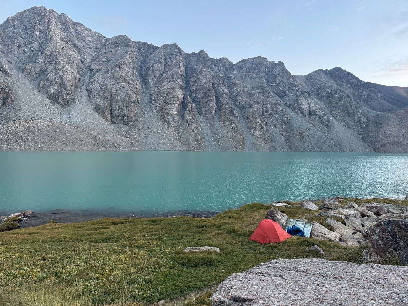
The Ak Suu traverse is a multi-day trek with itineraries commonly between seven and nine days. The trek is a chain of climbing alpine passes and descending into valley floors, showcasing the beauties of Central Asia and providing the backdrop for adventurous backpacking. It is the most difficult through-hike I’ve done, but also the most rewarding and stunning.
At high elevations (2800+ meters), the grass is lush and the alpine lakes are beautiful blues. Encounters with Kyrgyz nomads or shepherds, as well as grazing cows, sheep and horses are common.
As a remote location, trails were often unmarked or unclear. While this was not a technical trek, there is a lot of rock scrambling and steep terrain with loose soil and gravel. I definitely felt humbled in the face of nature.
📍 Important: This guide shows both my recommended itinerary (135km, 9 days) and what actually happened on my August 2025 trip (120km due to weather rerouting). Use the planned itinerary for your trip planning.
Ak Suu traverse difficulty rating: 4 out of 5, non-technical
Planned 9-day Ak Suu traverse specifications
| Total | Daily Average* | Total | Daily Average* | |
|---|---|---|---|---|
| Distance | 135 km | 16.5 km | 85 mi | 10.5 mi |
| Ascent | 6920 m | 865 m | 22,700 ft | 2,840 ft |
| Descent | 7285 m | 910 m | 23,900 ft | 2,990 ft |
*The daily average excludes the rest day at Altyn Arashan at Day 6
**As I rerouted my trip from my planned itinerary due to forecasted rainstorms, day 8 and day 9 are estimated distance, ascent and distance from GPX plots
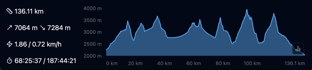
Elevation plot
—
In August 2025, due to a storm forecast, I modified my itinerary and walked 118km with a total ascent of 5917m, and a total descent of 6268m (see trip report at the end of post). The weather started sunny but became stormy over the last few days, with thunderstorms scattered throughout the area. As a result I made the decision to reroute and “escape” through one of the valleys on the last day.
Planning essentials
Where to buy or rent camping gear in Kyrgyzstan?
Equipment stores are rare and hard to find outside the cities of Bishkek and Karakol. Be well prepared, it is unlikely that you will be able to buy additional gear on the trail or in passing villages.
In Bishkek, you can rent gear from Trekking Union Kyrgyzstan, they also have Trekking Karakol/Jyrgalan maps available. You can buy camping gear and butane gas canisters from Sports Master or Red Fox.
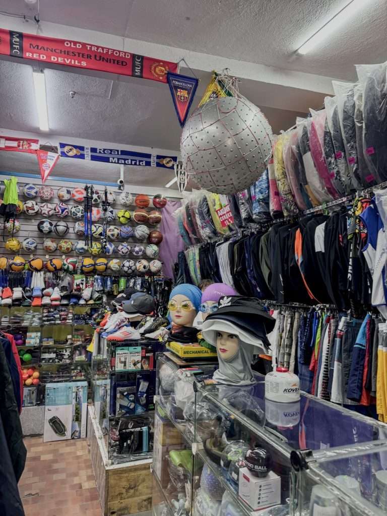
In Karakol, you can rent gear from Destination Karakol, they also have the paper Trekking Karakol/Jyrgalan maps available for sale (500 KGS as of time of writing). You can also buy ~200g butane canisters. I bought my butane canister from Sports Master for 700 KGS.
The selection is limited and it is close to impossible to find dehydrated or freeze dried camping food, water purification tablets or water filters here, so be sure to pack these essentials into Kyrgyzstan.
When is the best time of the year to hike the Ak Suu traverse?
Mid-June to August is the best time to hike the Ak Sun traverse. Any earlier and there may be remaining snow or ice at higher elevations or mountain passes. Late August or September onwards brings colder weather and snow. While I was there, there were late afternoon thunderstorms and brief snowfall (even hail) at high passes. The temperatures ranged from 28 degrees Celsius in the day at lower elevations to 2 degrees Celsius at night at higher elevations.
Should you hire a guide?
I hiked this trail solo and saw most people backpacking in pairs. This is a challenging hike that requires way finding and food supplies for the minimum length of your itinerary (7+ days), so if you are less experienced with navigation or carrying weight, consider engaging a local guide. The offices of Trekking Union Kyrgyzstan or Destination Karakol can help connect you to guides via WhatsApp.
Do you need to book accommodation in advance?
As of August 2025, there are yurts at every milestone or endpoint of each day. If you are a big group, contact Destination Karakol to guarantee and reserve yurt beds. If you are a pair or solo trekkers, you should be fine walking into yurts. I would recommend reserving beds at Altyn Arashan, which shares a stop with the popular and shorter Ala Kol trek and tends to run out of vacancies during peak season.

Yurts and accommodation often offers breakfast, lunch or dinner for fees. Beds can range from 2500 KGS per person (or around 3500 KGS for a 2-person yurt), breakfast and lunch around 600 KGS, and dinner at 800 KGS. Food, while generous, is also simple and carb-heavy, so expect to pay more for protein options like eggs or bring your own to supplement.
Expect amenities to be basic (freestanding toilet cubicle, no showers, no WiFi and no charging) with a few exceptions in Altyn Arashan.
I tent camped most of the way, except for a rest day in Altyn Arashan where I stayed at Arashan Hotel and on the last night where I stayed at Karakol Valley’s Kyrgyz Life Yurts to avoid the overnight storm.
Is there mobile reception on trail?
Except for the first 1 km or so from Jyrgalan Valley, there will not be mobile reception on the trail. Be sure to download offline maps or bring an emergency satellite device (I never leave without my Garmin InReach mini) with you.
Where can I get food on the trail?
Before starting off, I recommend stocking up on your last supplies at the Globus supermarket in Karakol. If you missed anything, there is a small supply store in Jyrgalan and they had basic milk, chocolate, instant noodles and snacks.
On the trail, do not expect to find hiker boxes or any stores. There are yurt camps at every milestone where it is likely that you will be able to get tea and dinner.
Where can I get water on the trail?
There are plenty of water sources on the trail, with rivers and creeks flowing from glaciers and alpine lakes. However, there is also a dearth of livestock grazing and pooping around these water sources.
Hikers I met simply filtered moving water, which gets rid of most protozoan bacteria, sediment and other contaminants. For my peace of mind, I filtered and then further treated my water to eliminate potential viruses from animal poop. These viruses are smaller than filters, like my Sawyer Squeeze. They can be eliminated through boiling, water purification tablets (I carry Katadyn Micropur 1-MP for emergencies) or with a UV pen like Steripen.
Getting to the start and end
Getting to the start point of Ak Suu traverse
The trek kicks off from Jyrgalan Valley. I landed in Bishkek airport, and from there I took public buses to the Bishkek bus station.
Modes of transport
- Public intercity transport, marshrutkas: these are minivans that leave on schedule or when full. You buy tickets (with additional big luggage charges) directly from drivers in cash. They usually travel along high ways, so you can let them know when you want to get off beforehand or in real time. Conversely, you can flag a marshrutka down from the side of the street to board one.
- Public intercity transport, shared taxis: shared taxis leave only from bigger bus terminals (such as the Ak Tilek Bazaar in Karakol). They leave when the car is full towards a common direction. You can approach the drivers directly.
- Hitchhiking: hitchhiking is common in Kyrgyzstan. You don’t use the hitchhiker’s thumb, but instead flag down cars like you would a cab. It is customary to negotiate a small cash fee with the driver with the destination before you get onto the ride. I personally did not succeed in getting a lift from another village, but I know others who have.
- Ridehailing: download the Yandex Go app to call taxis without the need to haggle for price. These are only available in the bigger cities like Bishkek and Karakol and do not provide for intercity travel. Solo or female-identifying travelers can also feel safer with the Comfort or Comfort+ options when traveling late night, which is what I used in Bishkek.
- Private transfers: to avoid planning uncertainty, you can also arrange for private transfers. I reached out to Destination Karakol on WhatsApp (number: +996 509 996 885) and got a quote for a transfer from Kok Jaik to Karakol. A car for 3-4 people costs 13,000 KGS (~$150 USD). A private driver from Altyn Tours costs $75-100 for the same route (feel free to contact me for their WhatsApp number).
How do you get from Bishkek to Karakol?
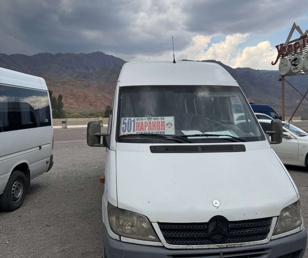
You can take a marshrutka from Bishkek to Karakol. A marshrutka is a minivan form of public transport. There are a few bus stations, be sure to get to the new bus stop at Leninskoe (Yandex Map, Google Maps).
When you get to the bus station, look for the 501 minivan that says Каракол and let the driver know you want to get to Karakol. You can directly pay the driver the fare: I paid 750 KGS, which includes a big luggage fee. We waited roughly 45 minutes for the marshrutka to fill up, and the journey took me roughly ~6.5 hours.
How do you get from Karakol to Jyrgalan?
To get to Jyrgalan, you need to get to the Ak Tilek Bazaar in Karakol (Yandex Maps, Google Maps).
The marshrutka #331 to Jyrgalan leaves from there at 8.30am, 1.30pm and 5.30pm in summer. When I was there, our marshrutka ended up leaving at 2pm.
The whole ride took close to 2 hours and I paid 150 KGS for my ticket and 50KGS for my bag.
The last two stops of the marshrutka are here, right at the midpoint of Jyrgalan village, and lastly here, which is closer to most guesthouses and the start point. Be sure to check where your accomodation might be.
Returning to Karakol from the end of the Ak Suu traverse
How do you get from Jeti-Oguz to Karakol?
Your trek takes you to Jeti Oguz resort, which is 15 KM from the town of Jeti Oguz. You can take a marshrutka, hitchhike, or chat with the resort to get a ride back to Jeti Oguz. There, you can take a marshrutka back to Karakol.
How do you get from Karakol Valley to Karakol?
This is the route I took; I hiked own the valley for about 2.5 hours until I reached a bridge, where there are private taxis. I hailed a private taxi and we paid 2000 KGS for the entire car to get to Duet Hostel, which is on the southern tip of Karakol. The ride took 20 minutes.
Escape Routes on the Ak Suu traverse
if nothing should happen to you during your treks you may hike down any of the valleys towards the nearest town or village, and look for a marshrutka or hitchhike to Karakol.
Ak Suu traverse map and waypoints
I do not recommend the Discover Kyrgyzstan Karakol & Jyrgalan topographic maps as your primary form of navigation. I had a copy of these, but they are of 1:100,000 scale and had pretty fat lines for the trails that made it hard to follow.
Instead, I used a combination of the AllTrails route* and an offline map of Kyrgyzstan on the Mapy.com app. The Mapy.com app also helped plot routes to yurt camps or pins that I input. *Note: the AllTrails route leads you via the Panorama pass after Ala Kol lake, which is known to be gnarly. Hikers are advised to take the Sirota Hut route instead.
If you’d like my .GPX routes or coordinates for my campsites and the natural hot springs at Altyn Arashan, feel free to email me at weiting[at]weitingwanders.com!
Ak Suu traverse itinerary options
7-day Itinerary – experienced hikers short on time
| Campsite | Distance | Ascent | Descent | Notes | Nearest yurt camp | |
|---|---|---|---|---|---|---|
| Day 0 | Jyrgalan | There are sport to camp by the river to help acclimatize to high elevation. | Many guesthouses. I stayed at Baitor Guesthouse. | |||
| Day 1 | Terim Tor Buluak | 15 km | 838 m | 122 m | Swampy and muddy land, try to follow trails on maps | Terim Tor yurt camp |
| Day 2 | Boz Uchuk Lakes | 24 km | 1465 m | 1214 m | Start with Terim Tor pass (3467m), followed by Boz Uchuk pass (3362m). Wide river crossing in between where bridge is washed away; there is another bridge 1 km downstream. The water reached waist level August 2025. | Boz Uchuk yurt camp, which is by Boz Uchuk river, before a climb to the lakes |
| Day 3 | Ak Suu almaluu | 18.5 km | +870 m | -1510 m | Unnamed pass (3516 m), then Alianyash Pass (3671 m) | Ak Suu yurt camp |
| Day 4 | Altyn Arashan | 15.5 km | +877 m | -1085 m | Anirtor Pass (3600m) | Many yurt camps and lodging options at Altyn Arashan |
| Day 5 | Ala Kol | 17.9 km | +1496 m | -487 m | Ala Kol pass (3960m) | Yurt camp before the steepest part of the climb to the lakes, and yurt and tent camps beside the lake |
| Day 6 | Telety Valley | 15 km | +1500 m | -1200 m | Take the Sirota Hut route to Karakol Valley, then turn left; the Panorama Pass route is known to be dangerous and gnarly. Start on the pass and reach Eco Trek camp to get a head start on the next day (5 km, +400 m) | Telety Creek yurt camp (Sirota Hut yurt camp is midpoint) |
| Day 7 | Jeti Oguz → Karakol | 24 km | +400 m | -1800 m | Climb the Telety Pass (3801 m), pass Eco Trek Camp and Kok Jaik to reach Jeti Oguz Resort. From Jeti Oguz Resort, get to Jeti Oguz village and back to Karakol. | Accomodation options at Jeti Oguz resort and Jeti Oguz town |
What if I have less than 7 days to hike the Ak Suu traverse? I recommend either trimming the start or the end of the trek. You can arrange for transport directly to Boz Uchuk lakes, skipping day 1. Alternatively, you can hike from Ala Kol to Karakol valley and take private transport or hike further to Karakol town on Day 6, effectively skipping day 7. The latter is what I did to avoid hiking and camping in thunderstorms on my last two days.
[Recommended] 8-day or 9-day Itinerary – advanced or experienced hikers
I highly recommend a 9-day itinerary with a rest day in the middle to enjoy the hot springs at Altyn Arashan and rest with some hot meals. This optional rest day (day 6) can be skipped to make an 8-day itinerary.
| Campsite | Distance | Ascent | Descent | Notes | Nearest yurt camp | |
|---|---|---|---|---|---|---|
| Day 0 | Jyrgalan | There are sport to camp by the river to help acclimatize to high elevation. | Many guesthouses. I stayed at Baitor Guesthouse. | |||
| Day 1 | Terim Tor Buluak | 15 km | 838 m | 122 m | Swampy and muddy land, try to follow trails on maps | Terim Tor yurt camp |
| Day 2 | Boz Uchuk Lakes | 24 km | 1465 m | 1214 m | Start with Terim Tor pass (3467m), followed by Boz Uchuk pass (3362m). Wide river crossing in between where bridge is washed away; there is another bridge 1 km downstream. The water reached waist level August 2025. | Boz Uchuk yurt camp, which is by Boz Uchuk river, before a climb to the lakes |
| Day 3 | Alianyash Lakes | 7 km | 620 m | 578 m | Unnamed pass (3516 m) | Jergez yurt camp, which is in the valley before Alianyash lakes |
| Day 4 | Ak Suu almaluu | Alianyash Pass (3671 m) | Ak Suu yurt camp | |||
| Day 5 | Altyn Arashan | 15.5 km | +877 m | -1085 m | Anirtor Pass (3600m) | Many yurt camps and lodging options at Altyn Arashan |
| Day 6 | Optional rest day at Altyn Arashan | Natural hot springs are 30 minutes walk down the valley from Arashan Hotel | Many yurt camps and lodging options at Altyn Arashan | |||
| Day 7 | Ala Kol | 17.9 km | +1496 m | -487 m | Ala Kol pass (3960m) | Yurt camp before the steepest part of the climb to the lakes, and yurt and tent camps beside the lake |
| Day 8 | Telety Valley | 15 km | +1500 m | -1200 m | Take the Sirota Hut route to Karakol Valley, then turn left; the Panorama Pass route is known to be dangerous and gnarly. Start on the pass and reach Eco Trek camp to get a head start on the next day (5 km, +400 m) | Telety Creek yurt camp (Sirota Hut yurt camp is midpoint) |
| Day 9 | Jeti Oguz → Karakol | 24 km | +400 m | -1800 m | Climb the Telety Pass (3801 m), pass Eco Trek Camp and Kok Jaik to reach Jeti Oguz Resort. From Jeti Oguz Resort, get to Jeti Oguz village and back to Karakol. | Accomodation options at Jeti Oguz resort and Jeti Oguz town |
Alternatives:
- Skip the Day 6 rest day for a day of side quests around Alianyash Lakes
Have an extra day? Make it a 10-day itinerary by exploring the Alianyash lakes.
After day 3 at the Alianyash Lakes, take an extra day to explore the side trails around Alianyash Lakes. These are roughly 5 km one way.
My Actual 2025 Trip Report (Weather-Modified Route)
For my actual trip in August 2025, I rerouted Day 8 and Day 9 from Ala Kol → Telety Valley → Jeti Oguz Resort to Ala Kol → Karakol Valley → Karakol River due to forecasted heavy and persistent thunderstorms.
Actual trip (reroute Day 8/9 to Karakol Valley → Karakol River, skipping one more pass)
| Total | Daily Average* | Total | Daily Average* | |
|---|---|---|---|---|
| Distance | 120 km | 14.5 km | 73.5 mi | 9.0 mi |
| Ascent | 5920 m | 730 m | 19,410 ft | 2,390 ft |
| Descent | 6270 m | 770 m | 20,571 ft | 2,526 ft |

(Optional) Day 0 Warm up: Jyrgalan
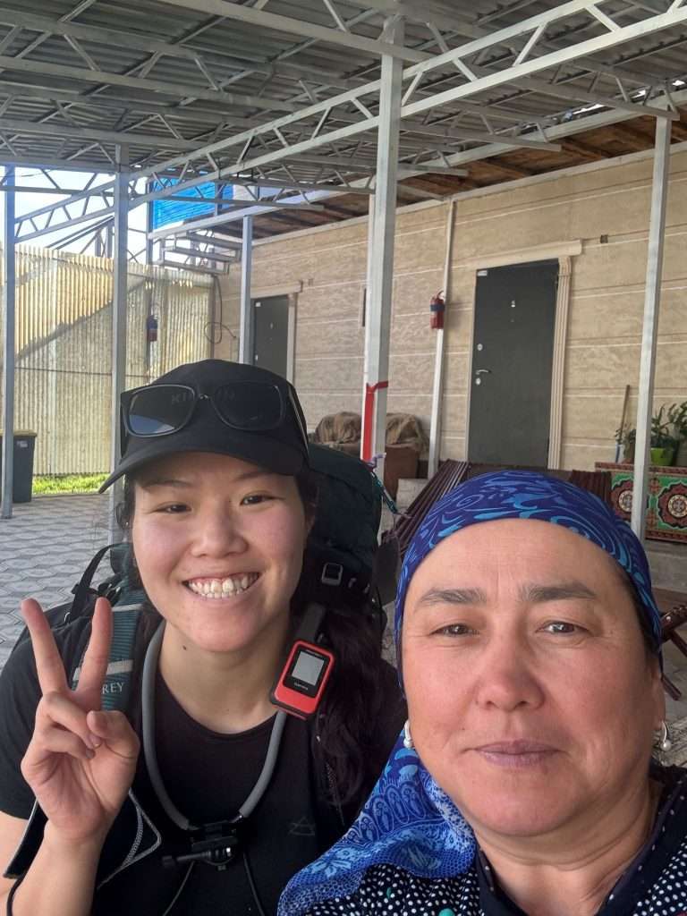
To warm up, I walked 7km along the start of the trail with my pack. I practiced flying my drone, and took notes of how well marked the trail is. It was my last chance to test my navigation system. The night in Jyrgalan (2800m above sea level) also helped me acclimatize to higher elevations.
Day 1: Jyrgalan → Terim Tor Buluak
- Distance: 15.1 KM, +838m, -122m
- Time: 8 hours
- Moving time: 5-6 hours
- Notes: I took my time with the first day, taking in the scenery and a lot of shots.
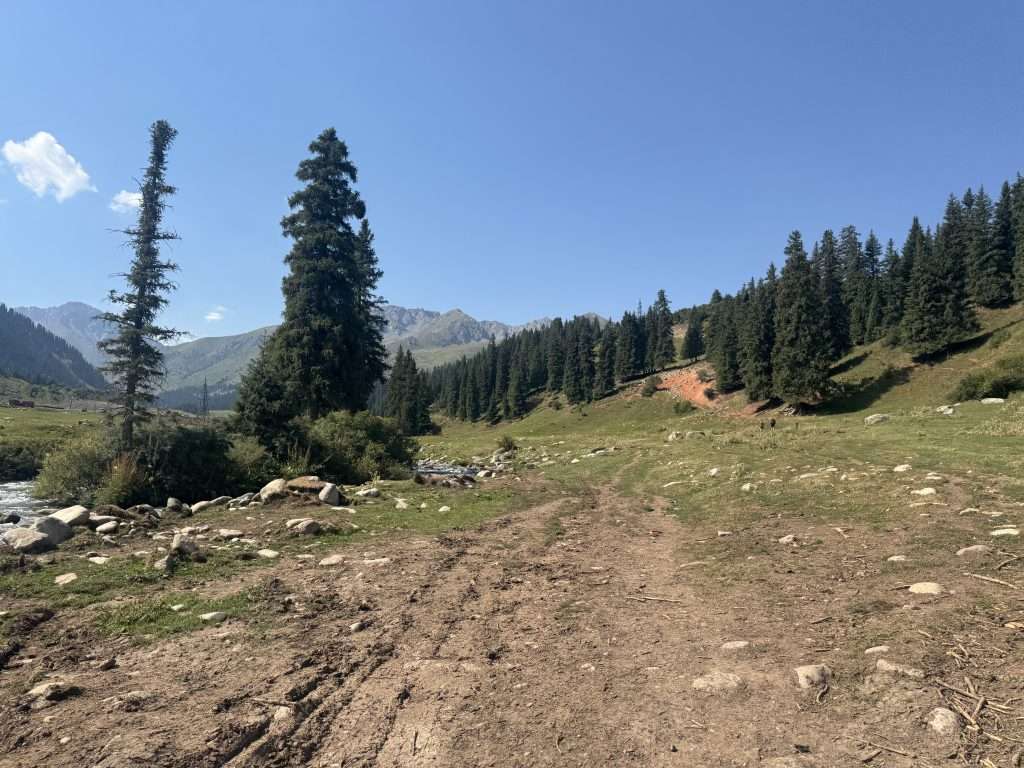
From the village, cross the river and walk along its west shore. The terrain is gentle and flat, the river a calming gush in the background. Watch your steps because it can be muddy, I sank one of my legs up to my knee in mud.
Soon, you will arrive on a jeep road and begin a gradual ascend.
Along the way, I came across a few seasonal nomads and grazing horses, even two young brother-shepherds.
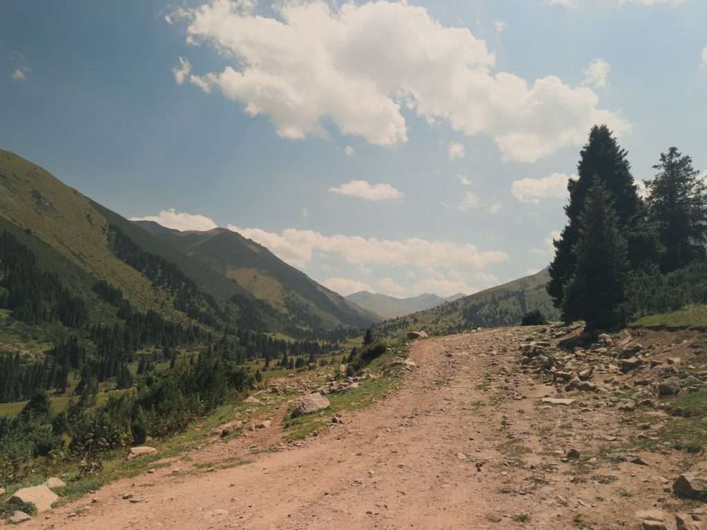
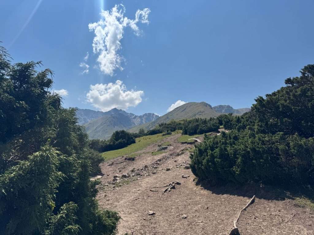
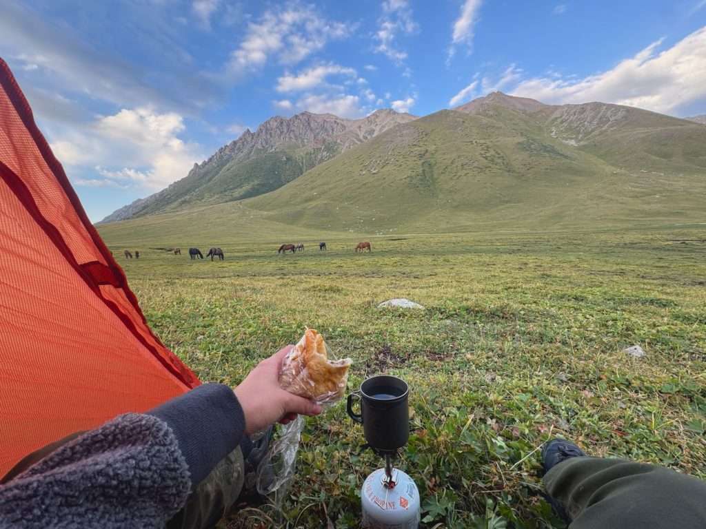
After climbing a small hill, you will descend onto a meadow that is 99% bog and 1% land. Follow the marked trail on the apps around the perimeter, no matter how tempting it might be to walk across.
You will finally pass Jyrgalan yurt camp. Follow along the river for roughly half an hour more and you will find flat (but marshy) camping spots at the foot of Terim Tor pass.
Day 2: Terim Tor Buluak → Boz Uchuk river
- Distance: 17 KM, +1065m, -1214m
- Time: 10.5 hours
- Moving time: 7.5 hours
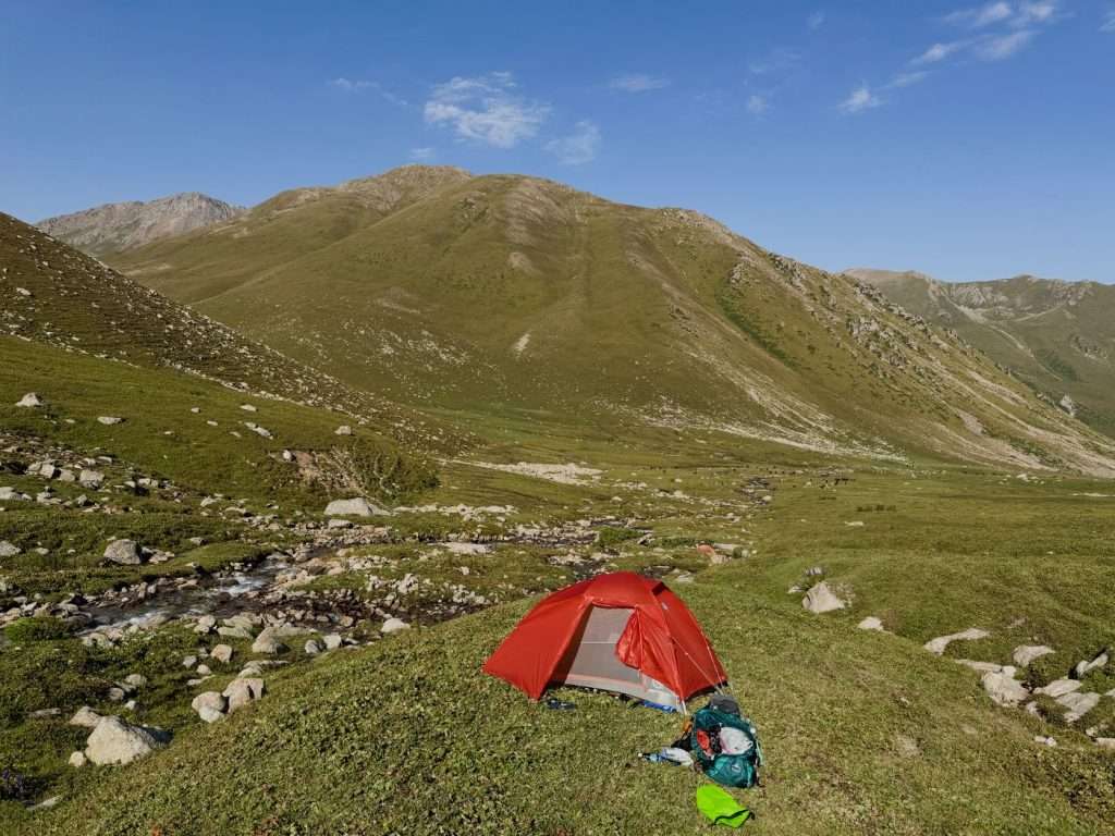
- Notes: I had not acclimated to the high elevation and hiked slower than usual. Also, the descend from the second pass is less than straightforward, without a clear trail and requires wayfinding around tough shrubs and over rocks. As a result I did not reach Boz Uchuk lakes, but camped by Boz Uchuk river half an hour to sunset. The planned itinerary would add 7.4 km (+400m) and 1.5-2 hours climb from the river to the lakes. To my understanding, most people camped by Boz Uchuk yurt camp and started the climb the next day; Boz Uchuk yurt camp is 1 hour from the lakes.
Day 2 is the second most strenuous day, with two separate passes and a wide river crossing.
Start with climbing Terim Tor pass (3467 m). The trail may not be obvious, but try to follow the marked trail lines on the apps as closely as possible as dispersed rocks and uneven grass will present themselves midway. That caused me quite a bit of detour to go around the rocks.
The first pass of the trek presents views that hold no candle to subsequent ones, but is still breathtaking.
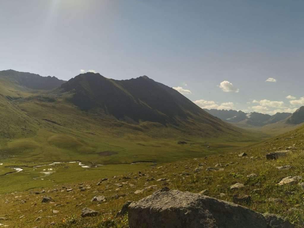
Descend downwards until you reach a river crossing. Here, you can take some time for a lunch break with the view, or continue onwards and take a break after crossing the river.
The bridge marked on the trekking maps has been washed away, however, I heard there is an alternative bridge around 1 km downstream. Otherwise, you can cross the river by foot (with proper precautions) – the water reached up to waist level depending on your height.
Alternatively, you pay this entrepreneurial 8-year-old boy to cross the river on horseback. He was hustling hard and I have to admit I have a soft spot for kids, so I paid him 1000 KGS to take me across. This was too much, I even heard of groups negotiating a bulk deal for 350 KGS per person, but after hesitating for 15 minutes I definitely lost my negotiating power.
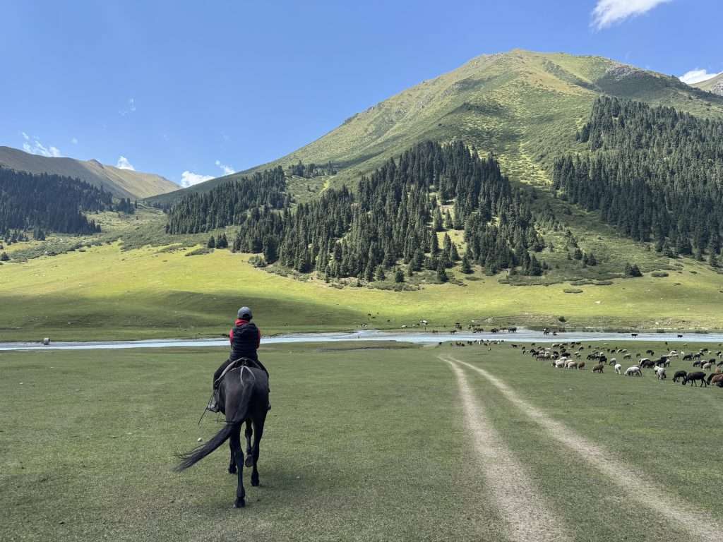
After crossing the river, you make another climb for Boz Uchuk Pass (3362 m). This time, the descend is steep and there is close to no trail. With shrubs galore, I had to find my way down to the next river. Keep an eye out for a turn to the left, the trail is not evident but is marked on the map.
There is another climb past the Boz Uchuk yurt camp to the Boz Uchuk lakes.
I underestimated the time it would take to get to the lakes, and set up camp at the foot of the climb. That was a good call because the climb to the lakes was strenuous and required scrambling over rocks. However, I got to the Boz Uchuk lakes for lunch the next day and they were absolutely gorgeous.
There are two of the lakes, both gorgeous. As I had the lakes to myself that afternoon, I enjoyed the solitude and took a dip.
Day 3: Boz Uchuk River → Jergez Valley
- Distance: 12.4 KM, +741m, -578m
- Time: 8.5 hours
- Moving time: 6.5 hours
- Notes: I camped at Jergez Valley before Alianyash lakes, rather than by the lakes themselves. This gave me the opportunity to recover from the late night I had before. The climb to Alianyash lakes would be a further 2.5 km and +280 m.
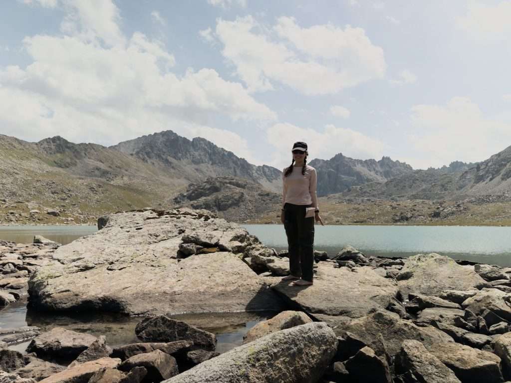
From the Boz Uchuk lakes, you follow along the slope of the mountains to another pass (3516 m). You can either follow the trail marked on the maps, which takes you uphill but is more straightforward, or you can follow along the contour line (at the same elevation) like I did and scramble over multiple rounds of rocks. Pick your adventure, I guess.
After the pass, you descend down into Jergez Valley. This is where I set up camp, and you can choose to do the same.
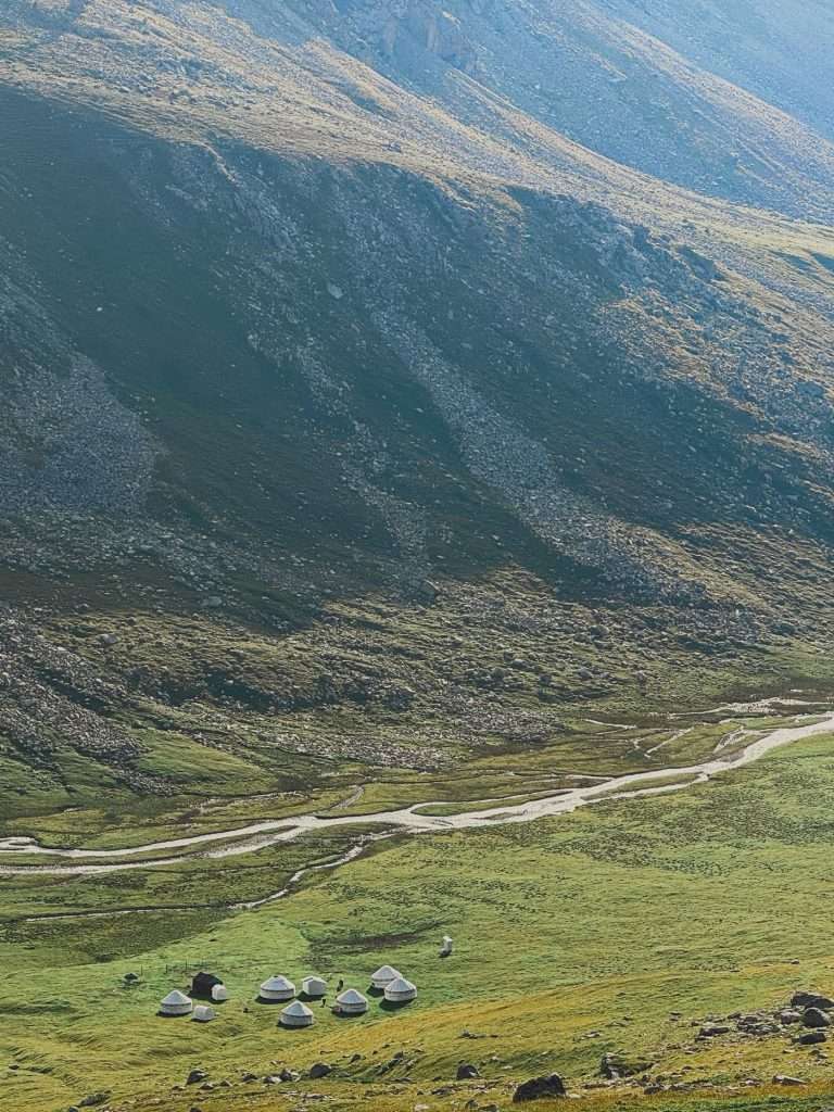
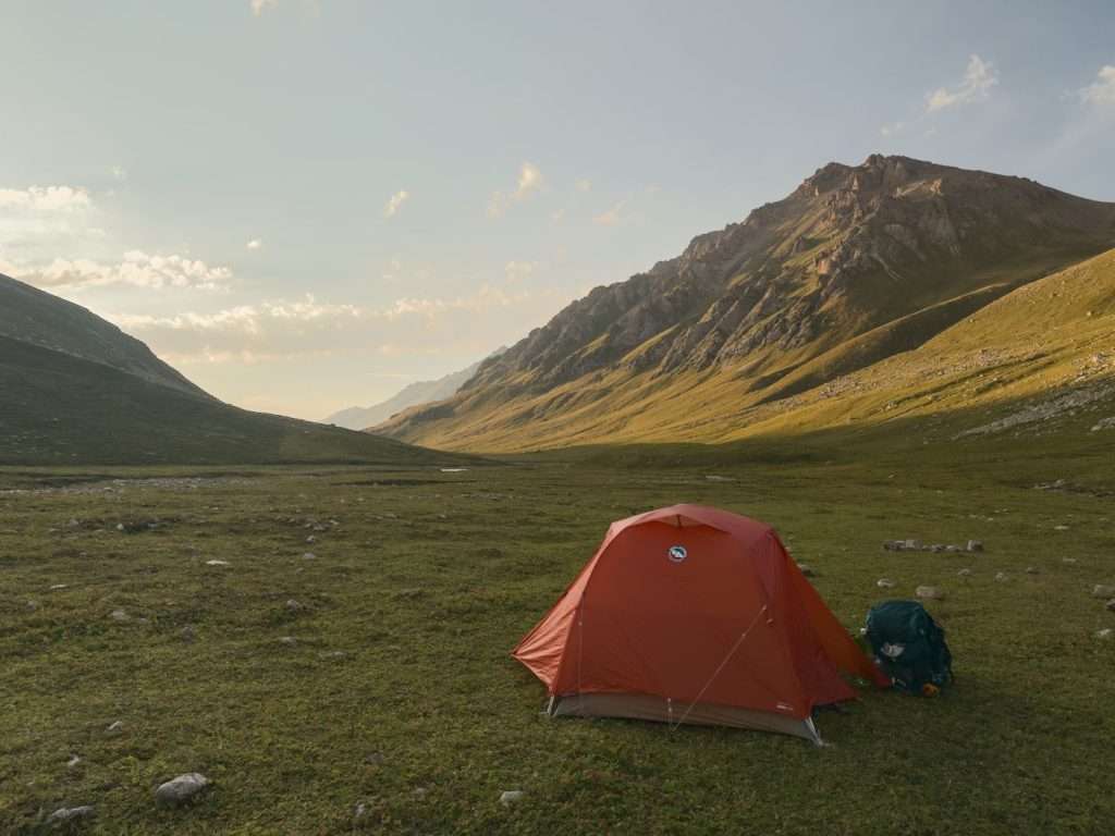
Alternatively, you can ascend to Alianyash Lakes. I found Alianyash Lakes to be quaint but underwhelming in comparison to the Boz Uchuk lakes. There are campsites around both of the alpine lakes and the trail takes you between the two of them.
Day 4: Jergez Valley → Ak Suu Almaluu (Ak Suu Valley)
- Distance: 14 km, +498m, -934m
- Time: 6 hours
- Moving time: 5 hours
- Notes: I caught up to the planned itinerary today, passing by Alianyash Lakes first thing in the morning.
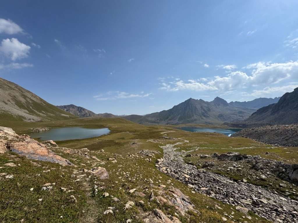
After the lakes is Alianyash pass (3671 m), a further climb. The view at the top of the climb however, is gorgeous – this is where you get your first peek of the glaciers in the region.
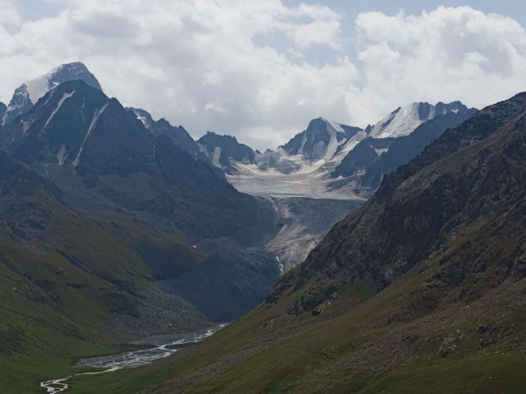
After Alianyash pass, you descend down into Ak Suu almaluu, a quaint and remote valley.
I had an encounter with a herd of sheep on the way, and after greeting the shepherd and having a short conversation with him, he signaled for me to follow behind him and he “parted” the sea of sheep for me. It was a surreal experience.
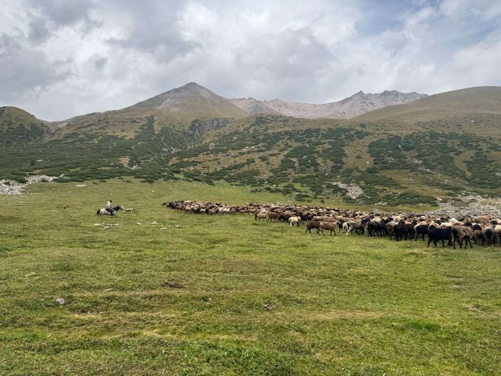
The descent down the valley is gradual. This is one of the shorter days. After following parallel animal tracks down the valley, you will eventually come to Ak Suu yurt camp.
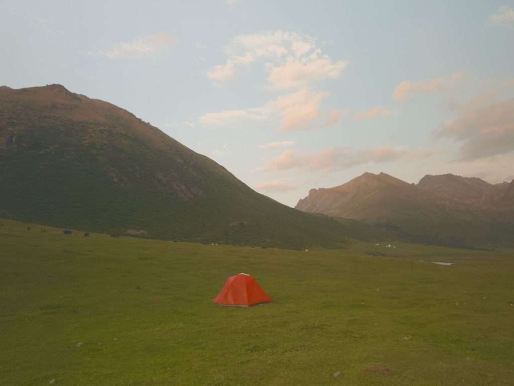
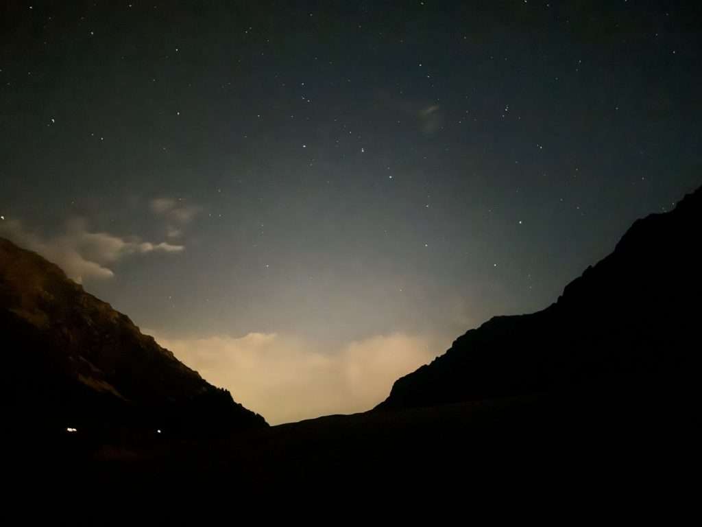
Continue on your way for approximately 20 minutes, and you will reach Ak Suu river. There are campsites by this river where you can hunker down and enjoy the company of grazing livestock with the earlier day’s end.
Day 5: Ak Suu Almaluu → Altyn Arashan
- Distance: 15.5 km, +877m, -1058m
- Time: 6.5 hours
- Moving time: 5.5 hours
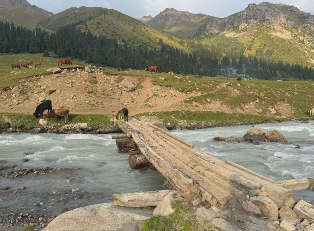
The day starts with another climb towards Anirtor Pass (3600 m). Follow the river to cross a bridge, then look for an opening in the trees which leads to the trail. The shepherd kindly pointed the way out to me after I greeted him, probably because I looked lost, but that saved me a ton of time.
The trail takes you through forest cover, although there are parts where you cross ravines, so once again look out for the trail on the map.
The last part of the climb is steep, but the switchbacks help manage the loose rocks. The view at the top, however, is absolutely stunning.
Look behind you at the valley, and look forward to a range of mountains. Absolutely gorgeous.
The descend almost makes you pay for the view. It is steep with a lot of loose rock, and the view of the grassy valley continuously teases you from ahead. Once you reach it however, it is a gradual descend with plenty of flat terrain, walking beside grazing horses and cows until you reach Altyn Arashan.
There are plenty of yurt camps and accommodations at Altyn Arashan. I had lunch for 800 KGS at Ernis Eco Yurt Camp – this is the first yurt camp you see, and comedically I was so hungry. It was a three course meal with soup, salad, and a main dish with free flow tea.
Descending further into the valley, you can set up your tent by the river and inform any yurt camps or accommodation of your desire to join for dinner.
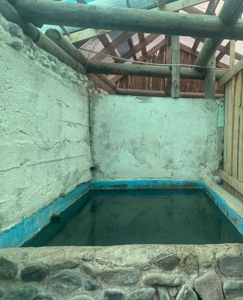
I chose to hunker down in a dorm room at Arashan Hotel, where for 1500 KGS, I had a bed, access to their private hot springs, breakfast in the morning, and a shared toilet.
Day 6: Rest day at Altyn Arashan
I took a day to rest, avoid an impending rainstorm, mingle with other travelers, and recharge my devices. I was also excited to explore for natural hot springs.
Altyn Arashan is known for their hot springs. However, these hot springs are not as easily accessible as one would expect. In the valley-town itself, you have to pay or stay at specific accommodations to access their hot springs: ELZA guesthouse and Arashan hotel are examples of where you can access hot springs.
You can also find natural hot springs at Altyn Arashan, which is what I did on my rest day. An half an hour hike down the valley in this direction brings you to the natural hot springs.
These hot springs are by the river and really surprised me; they are not that “natural” and are quite small. One of them was in a shape of a frog with a crown – that is the one I enjoyed in the company of friends I made along the way.
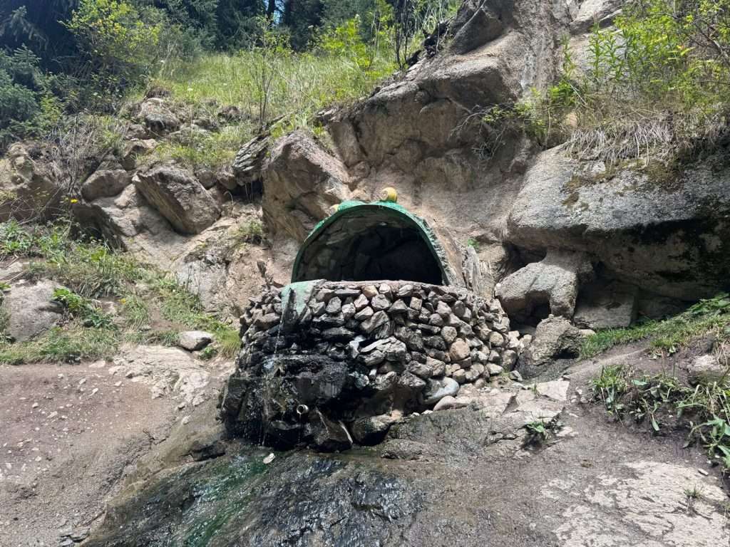
The temperature of the water was lukewarm at best, leaving me disappointed. The hot springs at Arashan hotel were much cleaner and hotter.
While it is an experience, it seems like it might be a gamble. Another group of friends who visited after me even said that the hot springs stopped flowing, and there was barely any water to take a dip in when they visited.
I spent a bulk of my time in Arashan hotel’s restaurant, where a Starlink connection provided WiFi to call my loved ones. I also played a game of chess, which I really enjoyed.
Day 7: Altyn Arashan → Ala Kol
- Distance: 17.9 km, +1496 m, -487 m
- Time: 10.5 hours
- Moving time: 9 hours
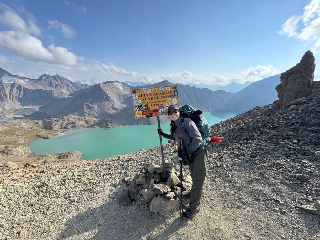
This is by far, the most strenuous day. Set off in the morning by crossing the river and heading up the valley. The climb is gradual for 95% of the way until you reach Ala Kol yurt camp. Here, the remaining 5% of the way is a steep climb with loose gravel. By holding your breath and following the switchbacks, you’ll soon reach Ala Kol pass, where the view will take your breath away.
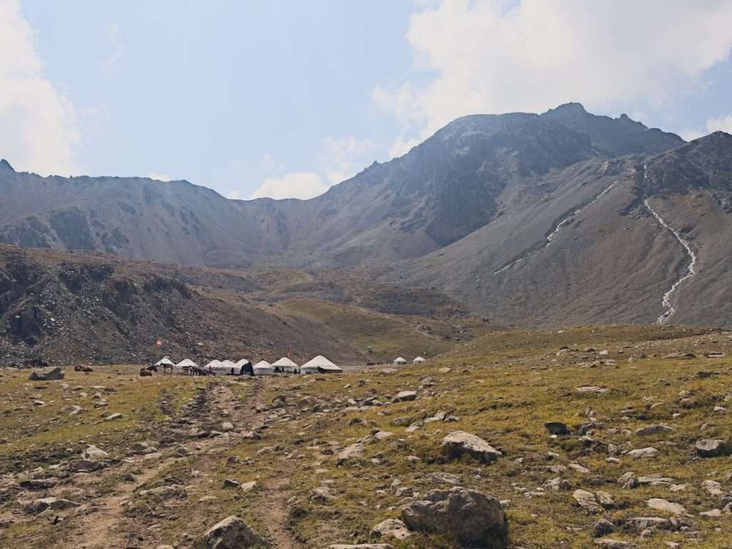
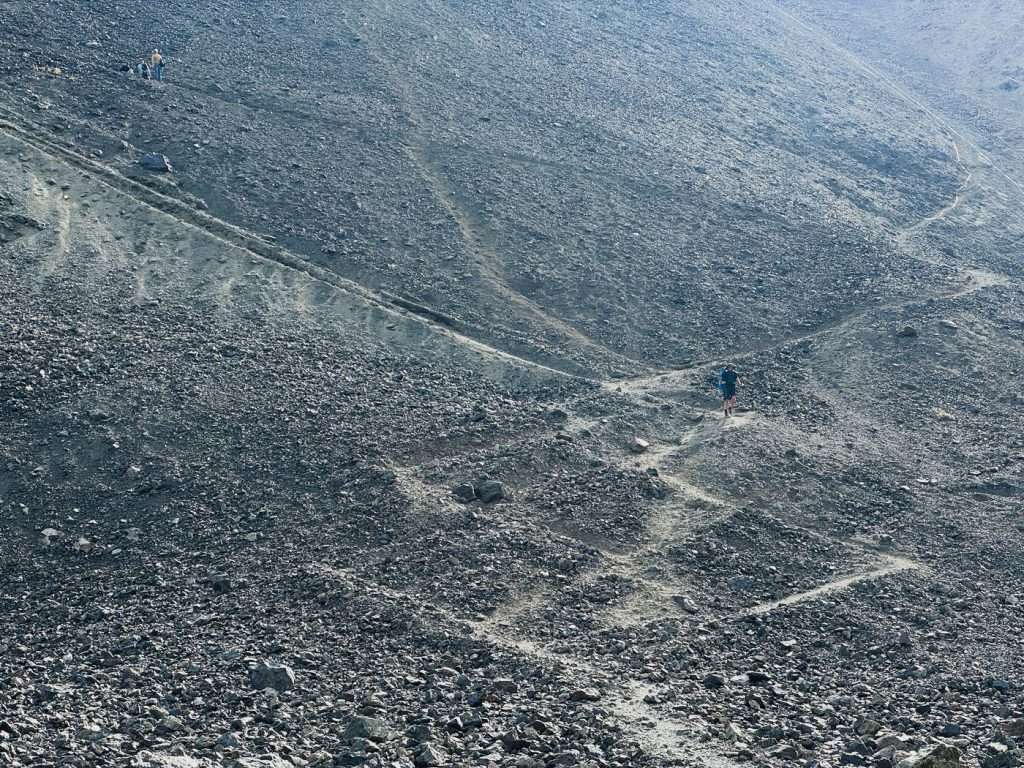
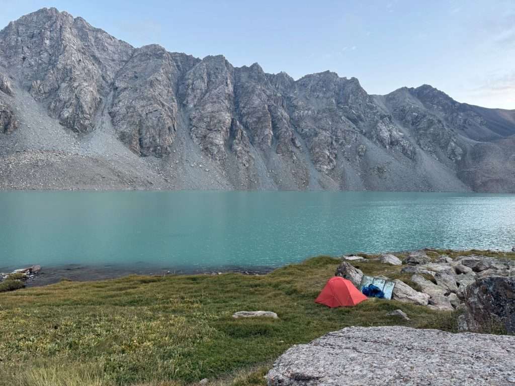
Look to your left and you see the amazing glaciers that gush into Ala Kol lake. Look downwards and you see the beautiful teal-blue alpine Ala Kol lake.
Take a moment to enjoy the view, then begin your descend with caution. There is plenty of loose rocks and steep trails here. Look out for gently formed switchbacks towards the shore of the lake if you want to camp by the lake, which is what I did, but be ready for a lot of sliding and rock scrambling.

The alternative is to follow the trail, which continues to take you uphill, until you reach the campsites overlooking the lake. These are on higher ground, but a 10 minute walk takes you to the shore of the lake.
There are two campsites by the exit end of the lake, a tent site and a yurt site.
Day 8: Ala Kol → Karakol Valley
- Distance: 13 km, +251m, -1266m
- Time: 7 hours
- Moving time: 6 hours
- Notes: I followed an incorrect trail and overshoot the bridge to the yurt camps, adding 0.5 km and 1 hour to my hiking time
From my campsite by the lake, I followed a trail to the tent campsites, then continued on.
The journey from Altyn Arashan to Ala Kol overlaps with popular shorter hiking itineraries to see the lake, so expect to see heavy traffic during peak seasons.
The descend, while steep and laden with loose rocks, gives you beautiful views of two waterfalls from the lake. As you complete a majority of the descent, you will walk along the gushing river between beautiful shrubs and colorful flowers. This is a great place for some solitude and lunch if you desire.
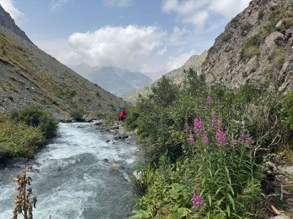
Continue your trek downwards. A portion of the trail requires rock scrambling, but roughly follow the marked trail on the map apps or look out for spray painted red arrows on rocks to emerge onto ground again. You will soon pass by a cluster of yurt camps, including the popular Sirota Hut yurt camp. These yurt camps may even have shops; I bought a soft drink from one of them.
As I continued on, I headed into a forested terrain and finally crossed Karakol river, ending up in Karakol Valley.
With a heart longing for just a night more in nature, I decided to stay at the Kyrgyz Life yurt camp. There is space to set up tents by the river, but there was a forecasted thunderstorm and I did not want to return to Karakol with wet gear.
I shared my yurt with a fellow traveller; we paid 3500 KGS for a yurt with two beds. I was quoted a single bed for 2000 KGS beforehand. My dinner was 750 KGS, and it was a three-course meal with bread, salad, and a instant food version of Beshbarmak. It was a little bare, but the yurt camp had wifi in the common area and a shop.
Day 9: Karakol Valley to Karakol
- Distance: 11 KM, +49m, -506m
- Time: 3.5 hours
- Moving time: 2.5 hours hiking + 20 minutes taxi
- Notes: The full walk is 25km, which is the standard across all routes down valleys to the nearest village. It is entirely downhill, which I estimate would take around 6 hours of walking.
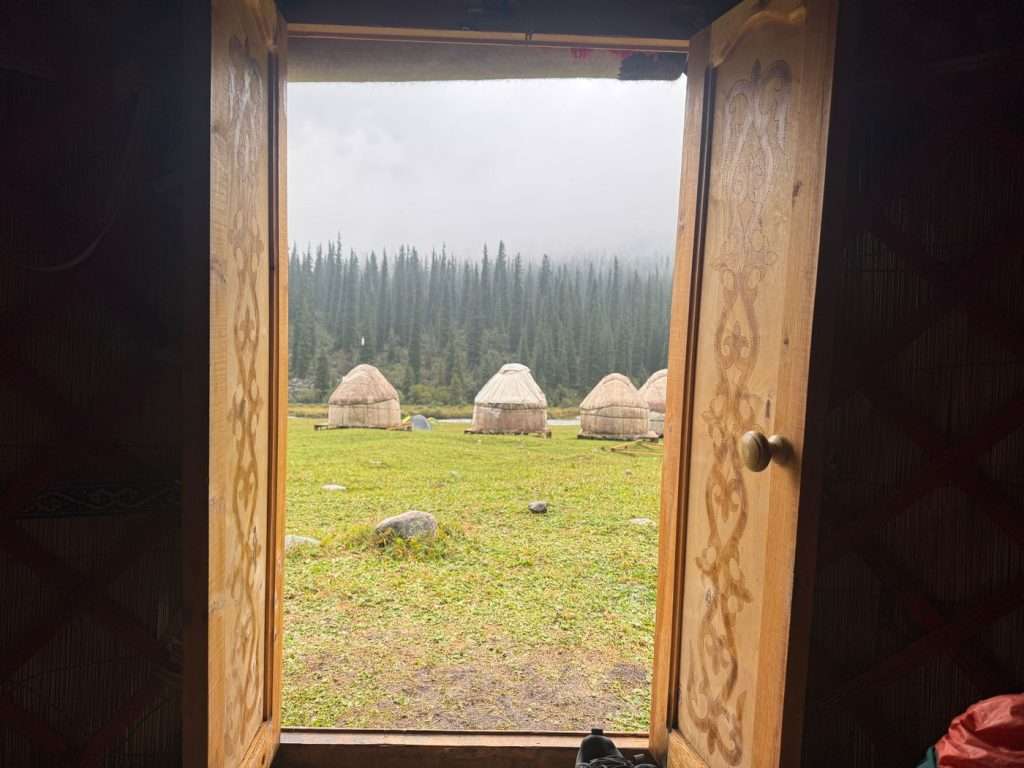
Thankfully, the thunderstorms passed overnight, leaving us with rain showers in the morning and afternoon. After contemplating our way back to Karakol over breakfast – 8000 KGS for a private car or trekking an estimated 7 hours towards the city – we decided to trek.
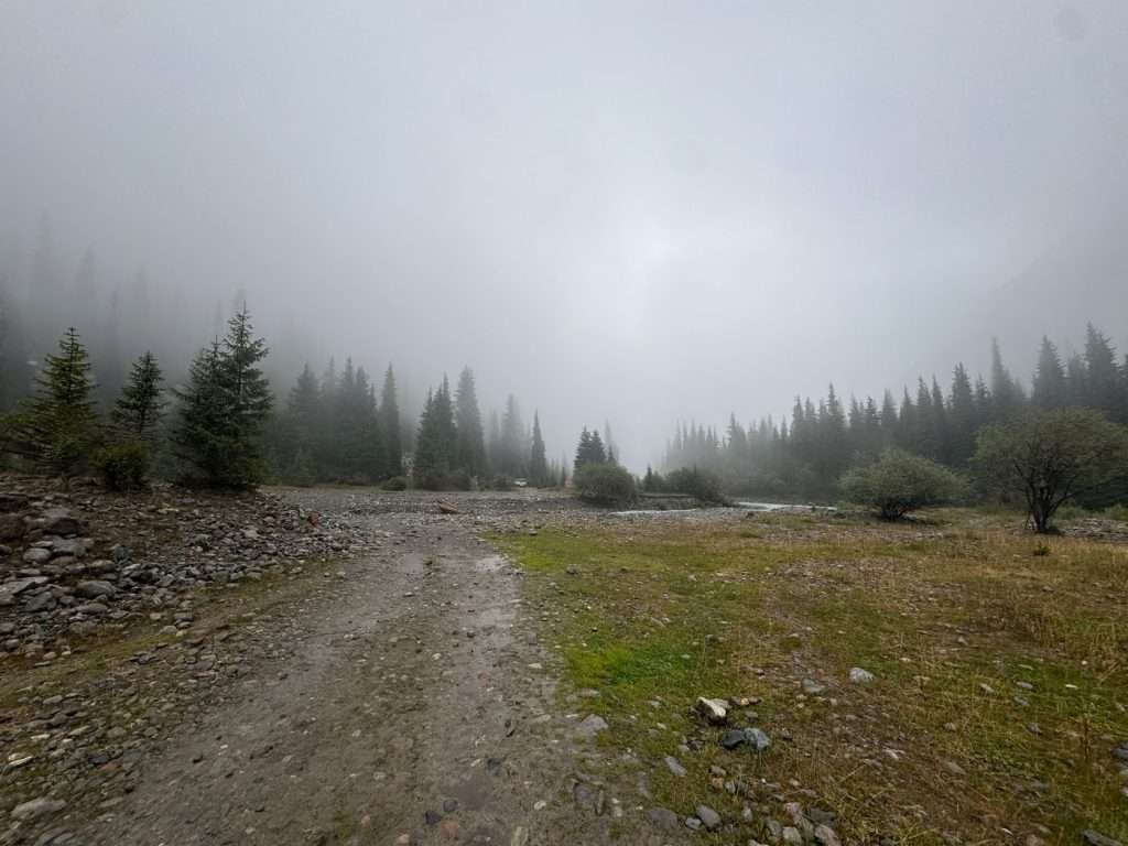
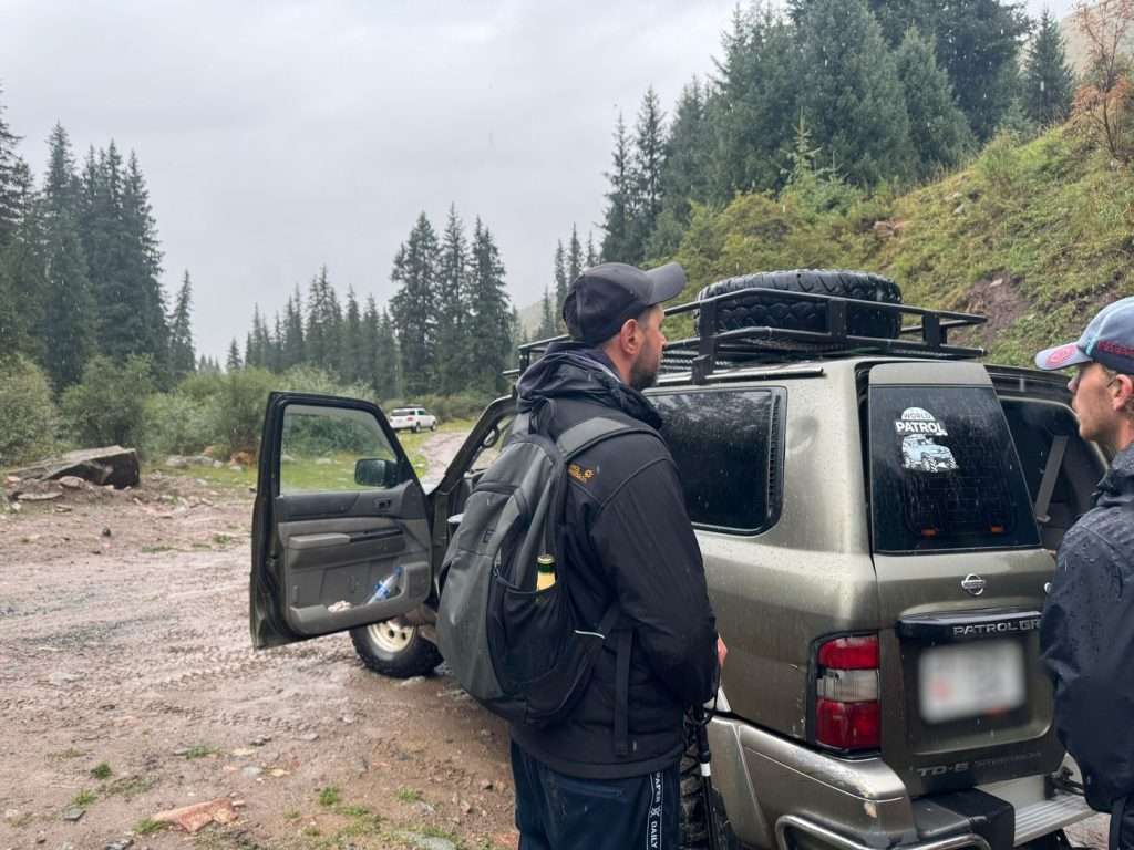
This was a heavily trafficked route in the other direction, as it overlaps with the first day of the Ala Kol Lake hike. The rain showers brought out a beautiful smell among the pine trees but made the route slippery and muddy – trail shoes with good grip were helpful here.
After 2.5 hours of walking along the jeep road, we came along the first of two bridges crossing the Karakol river, where we made a wish. My companion and I found a horse shoe along the way. In his Polish customs, he believed that by throwing the horseshoe into the river, we could make a wish. I wished for good health and wealth.
By the bridge, a shared taxi driver had just dropped someone off. We negotiated a fare of 2000 KGS with him to take five drenched hikers to Duet Hostel, which is the southern end of Karakol. The ride was approximately 20 minutes, and the Kyrgyz music playing with the patter of the rain on the car set a melancholic but poetic backdrop to the end of my trek.
What to pack for trekking in Kyrgyzstan?
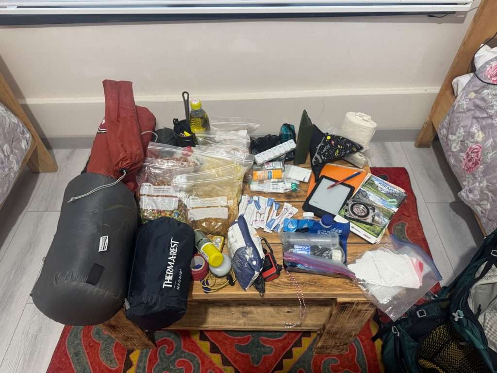
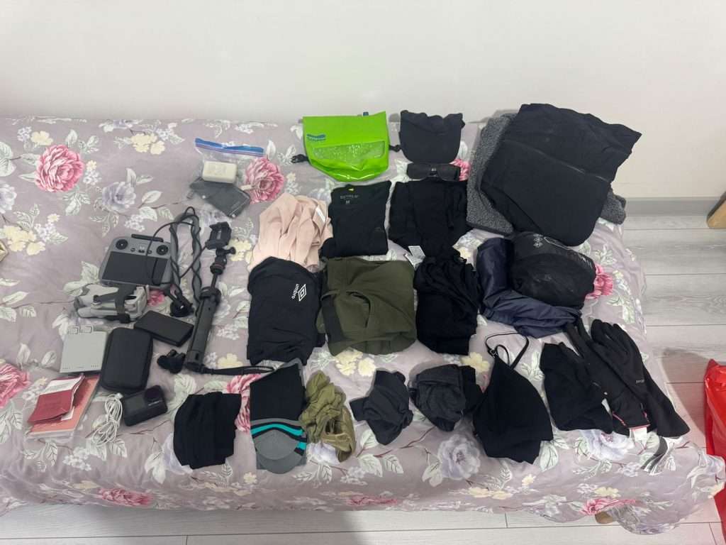
The weather and as a result, terrain, on this trek is unpredictable and can get wet and cold. I would advise anyone to bring layers and rain gear to stay safe in the mountains.
Additionally, the majority of the trek aside from the Altyn Arashan to Ala Kol lake segment is remote with low foot traffic. One should be prepared for emergency situations.
Must-have gear and items
- Backpack
- Waterproof backpack liner – I use a simple plastic bag
- Shelter and sleep systems
- 3 season sleeping bag or quilt
- 3 season sleeping pad
- Tent: I do not recommend a hammock, as majority of the campsites had little trees around
- Clothing and layers
- Hiking shirt and pants (ideally UPF rated)
- Extra set of shirt and pants – lightweight
- Hat or cap
- Sunglasses
- Thermal top and bottoms – temperatures dropped down to 2 degrees while I was there
- Two sets of underwear
- Three pairs of hiking socks – I use layers of merino wool Jinji sock liners under Darntough hiking socks to mitigate blisters and toes rubbing
- Lightweight down jacket
- Lightweight fleece jacket
- Rain poncho with hiking backpack cover
- Navigation and safety
- Offline map of Ak Suu traverse on All Trails downloaded
- Offline map of Kyrgyzstan on Mapy.com downloaded
- Satellite device – I used my Garmin InReach Mini 3 to keep my loved ones updated and get weather forecasts
- (Optional) Compass and trekking map of Jyrgalan/Karakol – I do not recommend using this as a primary method of navigation as the map scale of 1:100000 is not conducive to seeing trail details. It only gives you a general direction.
- Cooking and water
- Water filter – Sawyer water filter
- Water treatment – Steripen or Katadyn Micropur tablets
- Cooking system – Soto Amicus camping stove with ignition
- Butane gas tank
- Cooking utensils – I brought only my MSR camping cup and an MSR camping spoon, because my food only required boiled water
- Food (at your own discretion and itinerary)
- 12 packs of dehydrated food: breakfast and dinner excluding start, end, and rest days
- 1.5kg of custom trail mix
- 500ml of olive oil which I poured into a plastic bottle, to help with calories
- Hygiene and toiletries
- Biodegradable soap
- Toothbrush
- Toothpaste
- Shovel to dig catholes
- Toilet paper
- Stick sunscreen
- (If applicable) Disposable contact lenses and glasses
- (If applicable) Daily medication or supplements
- First aid kit – should include a tick tweezer, and leukotape or blister tape. I also used alcohol wipes and plasters for small cuts.
- Electronics
- Smartphone – for navigation
- Powerbank
- Headlamp
Optional gear
- Electronics
- Backup powerbank
- Camera – I brought my waterproof DJI Osmo Action 5 and a DJI Mini Pro 4 drone, with corresponding batteries
- Waterproof socks or waterproof shoes – I highly recommend waterproof socks for unavoidable creek and river crossings. Most people will recommend Goretex or waterproof shoes, but I dislike those as they trap water and keep my feet wrinkled and cold.
- Dry bag for laundry – I use a Scrubba mini bag for laundering my socks and underwear with soap. It was also helpful in keeping my electronics dry in the rain.
- Trekking poles (recommended) – to each their own, but I found walking with four “feet” helped me keep my balance on especially steep terrain
- Gloves and warm hat (recommended) – it was storming and raining during the later half of my trek. I was very grateful for my gloves and hat. I even had a friend ask if I might have a spare pair of gloves because it was so cold.
- Lightweight rope – I use Dyneema rope for emergencies, repair, clothes line etc.
Meal plan for Ak Suu traverse
I packed 12 dehydrated meals, a 500ml bottle of olive oil (poured into a plastic bottle) and 1.5 kg of my own trail mix.
| Breakfast | Lunch | Dinner | |
|---|---|---|---|
| Day 0 | Lodge/town | Lodge/town | Lodge/town |
| Day 1 | Lodge | Fresh packed | Fresh packed |
| Day 2 | Dehydrated meal | Trail mix | Dehydrated meal |
| Day 3 | Dehydrated meal | Trail mix | Dehydrated meal |
| Day 4 | Dehydrated meal | Trail mix | Dehydrated meal |
| Day 5 | Dehydrated meal | Lodge | Lodge |
| Day 6 | Lodge | Lodge | Lodge |
| Day 7 | Lodge | Trail mix | Dehydrated meal |
| Day 8 | Dehydrated meal | Trail mix | Dehydrated meal |
| Day 9 | Dehydrated meal | Lodge/town | Lodge/town |
How much does it cost to hike the Ak Suu traverse?
The below is what I spent on my Ak Suu traverse trip, including my arrival day at Karakol and a Day 0 at Jyrgalan. You should expect to spend between $130 (budget) to $485 (yurt-to-yurt) for a 9-day itinerary.
- Gear: I did not buy any gear as I brought my own. I did buy a butane gas cannister.
- Food: Most of my meals on trail were pre-packed dehydrated meals and trail mix, unless specified. I ate or packed warm meals at the start, middle (at Altyn Arashan) and end of my trip. You can find me meal plan below.
- Yurt costs: Yurts usually cost between 2500 – 3500 KGS for a bed and hot tea, ~850 KGS for dinner, ~650 KGS for breakfast and lunch. All yurts, aside from at Altyn Arashan, have shared toilets and no showers. (As of Sept 2025)
- Karakol national park fee: You may have to pay this 300 KGS tariff after crossing the Karakol river bridge. A park ranger may approach you, and you can say that you entered the park from the other side.
| Day | Item | Full yurt-to-yurt | Mixed tent/lodge camping | Full tent camping |
|---|---|---|---|---|
| Arrival day | eSIM | 500 | 500 | 500 |
| Marshrutka from Bishkek to Karakol | 750 | 750 | 750 | |
| Map of Karakol & Jyrgalan trekking | 500 | 500 | 0 (mobile apps) | |
| Gas cannister ~220g | N/A | 700 | 700 | |
| Groceries for trek (nuts, raisins, milk, chocolate, olive oil) | 1700 | 1700 | 1700 | |
| Karakol lodging (incl. breakfast) | 4785 | 4785 | 1250 | |
| Dinner in town | 315 | 315 | 315 | |
| Day 0 | Marshrutka from Karakol to Jyrgalan | 200 | 200 | 200 |
| Lunch in town | 315 | 145 | 145 | |
| Jyrgalan lodging (incl. breakfast) | 3900 | 3900 | 0 (tent) | |
| Dinner at lodge | 800 | 800 | 800 | |
| Day 1 | Packed lunch for day 1 of trek | 400 | 400 | 400 |
| Day 2 | River crossing tip for boy on horseback | 1000 | 1000 | 0 (cross on foot) |
| Day 3 | Yurt camp + breakfast + dinner | 5000 | 0 | 0 |
| Day 4 | Yurt camp + breakfast + dinner | 5000 | ||
| Day 5 | Lunch at lodge | 800 | 800 | |
| Altyn Arashan lodging (incl. breakfast, hot springs) | 4500 | 1500 | 0 (tent) | |
| Arashan Hotel / Kyrgyz Life WiFi | 200 | 100 | 100 | |
| Dinner at lodge | 950 | 950 | 950 | |
| Day 6 (rest day) | Altyn Arashan lodging (incl. breakfast, hot springs) | 4500 | 1500 | 0 (tent) |
| Dinner at lodge | 950 | 900 | 900 | |
| Day 8 | Karakol Valley yurt bed | 2500 | 1750 | 0 (tent) |
| Karakol national park fee | 300 | 300 | 300 | |
| Dinner at lodge | 800 | 750 | 0 | |
| Treats at shop by Karakol river (beer and a banana) | 500 | 500 | 0 | |
| Day 9 | Private driver from Karakol bridge to Karakol (2000 for one taxi) | 2000 | 400 (split by 5) | 400 (approx marshrutka cost from Jeti Oguz resort) |
| Total KGS | 42,365 KGS | 24,145 KGS | 11,460 KGS | |
| Total USD | ~485 USD | ~275 USD | ~130 USD |
Is card accepted in Kyrgyzstan?
Your credit card is unlikely to be accepted at most places – and definitely not on the trail. ATMs are available in Bishkek and Karakol, but not in Jyrgalan nor on the trail. Carry enough cash with you for your trip and for emergencies.
Is it safe to hike the Ak Suu traverse solo?
I hiked the Ak Suu traverse as a solo woman and that was definitely met with surprise from other hikers on the trail. I did not meet any other solo woman, but I did meet two other solo hikers. I did not feel danger from other hikers or locals at any point on the trek. I greeted shepherds and nomads I cross paths with and they were all varying degrees of curious and friendly.
However, I did feel like I put myself in dangerous situations of nature at various times. Try not to go off trail, even if it appears simpler or more direct, and corroborate often with the trails on the apps. There are many animal and other trails that can be misleading. At other times, the trail may seem to disappear. When I tried to self-navigate, I got lost, found myself on steep slopes with loose soil, or had to scramble over extra amounts of rocks at high elevations.
Otherwise, stick to best practices of leaving your itinerary with a loved one or with your accommodation and you will be fine.
How to prepare for emergency evacuation on the Ak Suu traverse?
If you are hiking solo, I highly recommend:
- Informing your loved ones or your guesthouse of your itinerary
- Emailing your itinerary to yourself
- Carrying a satellite communication device with SOS capabilities; I carry a Garmin Inreach Mini 2. There is no mobile reception in Kyrgyzstan’s backcountry.
- Carrying a basic first aid kit
In emergency situations, be prepared to hike down any of the valleys as potential escape routes (marked out on the map above). Mountain rescue may take some time in Kyrgyzstan.
How to prevent altitude sickness on the Ak Suu traverse?
The Ak Suu traverse takes place at high altitudes and involves rapid ascents, including 2250m to 3100m on day 1.
Altitude sickness can affect hikers who are not acclimatized and is more common above 2500 meters, this is regardless of physical fitness.
To minimize the risk of altitude sickness from affecting your adventure, spend the night before embarking on the Ak Suu traverse in Jyrgalan (2230m) to acclimatize to the higher elevation.
I spent the night before in Jyrgalan but still felt weaker and hard for air than usual on my first few days.
On the trail, monitor for altitude sickness symptoms and always descend until symptoms subside.
Cultural etiquette and interactions
Basic Kyrgyz and Russian language
It was helpful and heartwarming to be able to connect with locals using basic Kyrgyz and Russian phrases. All locals will understand Kyrgyz, but Russian is spoken to varying degrees depending on where you are. In the big city of Bishkek, locals converse in Russian with each other. In other areas, such as Karakol, Jyrgalan, or in the mountains and valleys of the Ak Suu traverse, locals speak Kyrgyz.
You can greet Kyrgyz with ‘Salam-a-laikum!’ or ‘Salam!’ for short. ‘Rahmat’ means thank you, and ‘Kun-dah-y?’ means ‘Where are you from?’, which is a common question curious shepherds will ask. Note that ‘Beer’ could be mistaken for ‘Bir’, which means one in Kyrgyz.
Meeting others on trail
I trekked during peak season and met roughly five to six people a day until Altyn Arashan. From There are many more hikers between Altyn Arashan, Ala Kol and Sirota Hut, which overlap with the shorter Ala Kol day and through hikes.
Ak Suu Traverse vs Ala Kol Lake Trek: Which should you choose?
If you love a consistent challenge, solitude and remoteness, and are curious about encounters with shepherds and nomads, I highly recommend the Ak Suu Traverse or a variation of it.
Alternatively, if you are mostly curious about Ala Kol and Altyn Arashan, which are two highlights of the trail, I recommend the 4-day Ala Kol Lake trek. From Karakol, head to the Karakol national park entrance and take a shared taxi or hike down Karakol river. The abridged itinerary / campsites for each night: Karakol Valley → Ala Kol lake → Altyn Arashan → Karakol. From Altyn Arashan, hike down the valley to Ak Suu village and take a marshrutka to Karakol.
Where to relax after the Ak Suu traverse: Tosor guide
After my nine-day adventure in the Ak Suu region, I spent a day unwinding and cleaning my gear in Karakol. I really cherished a hot meal after spending the day in the gloomy rain. The next day, I took a marshrutka along the south shore of Issyk Kul – the second largest alpine lake – and decompressed at the remote beach town of Tosor. I even took a day trip from Tosor to see the multicolored Fairytale Canyon (Skazka Canyon). The guide for Tosor will come in the next few days.

Leave a Reply